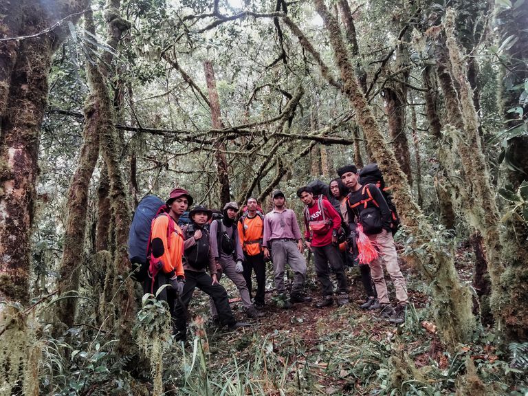
I hope all of my friends have a nice day, I feel very happy if all of my friends are willing to take the time to read my post, a record of a mountain forest expedition trip that I did with my team, a small solid and great team, so I feel when taking a trip with them. We named this team the Savana Eagle.
The Savana Eagle Team managed to climb Mount Kapal. A mountain located in Permata District, Bener Meriah Regency, in Aceh Province - Indonesia with an altitude of 2,783 Meters above sea level (Masl).
This Expedition activity was entitled "The Spirit of a Decade of Serving". This activity aims to train and test the skills of members in the discipline of mountain forest, as well as explore places that we have never visited.
First day
This morning was colder than usual, of course because at this time we were in a village located at the foot of Mount Kapal, the people in this village called it Bur Kapal.
After cooking and eating breakfast we started packing all our equipment and checking it again, getting ready to start this journey.
The clock in my hand showed that it was 09.00 am, we did a brief briefing and continued with a prayer for the safety and smooth running of this activity.
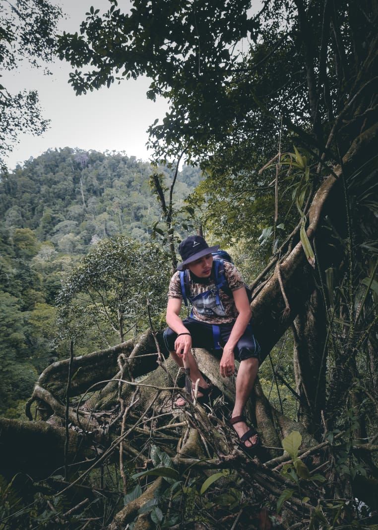
My team and I started the journey from the starting point 04°48'21.08" N, 96°52'58.38" E which is in Bener Pepanyi Village, with a planned route of 6,400 meters, but believe me this is not as easy as we imagined when walk on a flat track without climbing.
Under the rain, of course with strict safety standards, the team began to walk through the dense jungle to reach check point' 1 which is at point 5 with coordinates 04°48'35.68" N, 96°51'32.45" E which is at an altitude of 2,512 Masl. The trip was stopped several times due to heavy rain and strong winds. It was getting dark, especially under the dense jungle, it was getting darker, finally the team managed to arrive at check point' 1. At this point we had planned to camp on the first night of this hike. With the remaining energy that was still there under the rain we started setting up a tent to rest tonight.
After cooking and finishing eating, we discussed for a while to make sure the team's health was in good condition, checked the rest of the supplies and equipment, evaluated today's fishery and discussed plans for tomorrow.
The second day
In the morning, in the cold mountain air typical of Central Aceh, we woke up still in the rain. it looks like the trip on the second day will be delayed by a few hours than planned due to heavy rain and strong winds.
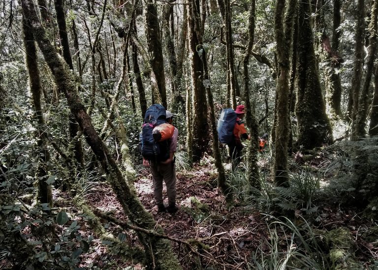
After breakfast we repacked all our equipment, it seems that the rain has started to subside and the team started moving to reach the 2nd check point which is at coordinates 04°48'56.76" N, 96°51'12.16" E which is at an altitude of 2,772 Masl.
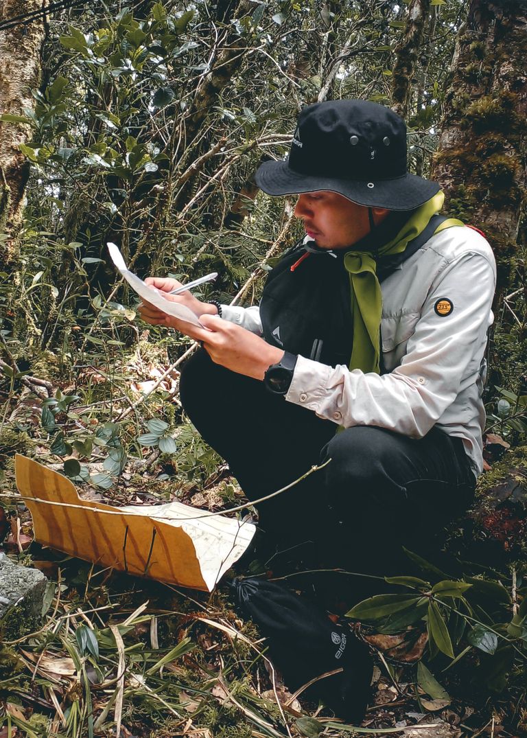
Along the track, we can find many kinds of orchids, humid and wet tropical rain forests. Lots of moss attached to the thick trees ranging from 10-15 cm. Approaching the 2nd check point, the team found several inactive traps/snares that might have been left by the hunters for a long time. We started to increase our vigilance watching each other's team movements, fearing that there were still active traps. Here we found a lot of animal tracks and their droppings could be mountain goats or something.
Finally we arrived at the 2nd check point, with the remaining energy we had to put up the tent for the night. We started to divide the tasks, some were installing, cooking, and looking for firewood.
After dinner we sat around what while warming ourselves with coffee, cigarettes and a few snacks. The discussion started again like last night, not long after that we went to get some rest early, to keep our stamina more fit tomorrow morning.
The third day
This morning feels different from the previous morning, the weather this morning looks brighter, just a little strong wind.
We started out of our respective tents and started preparing breakfast to meet our calorie intake, which will burn a lot when we travel again. As usual, after breakfast we started unpacking the tent and packing up all the equipment that we unloaded yesterday when we arrived at the 2nd check point.
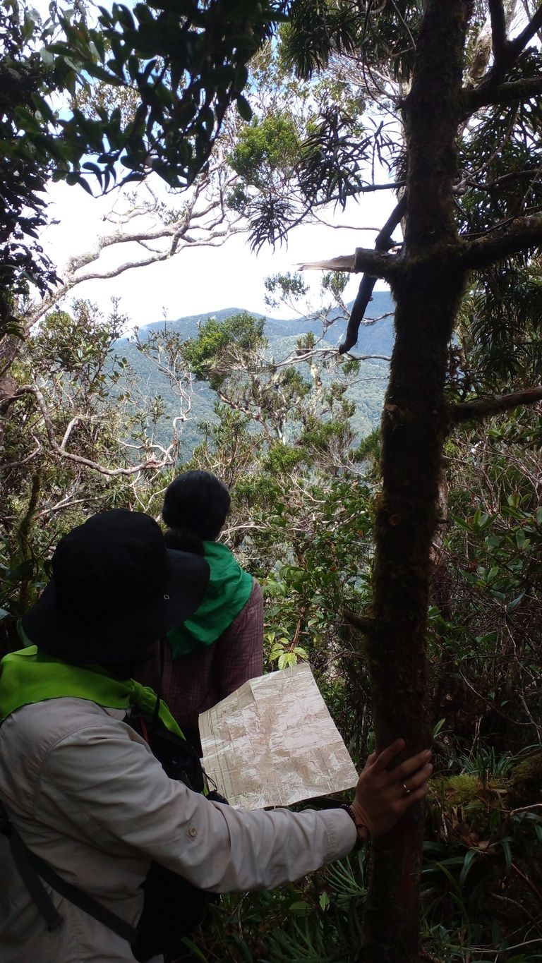
After everything was packed properly according to the needs on the way, we started moving again, this is the journey to the top of Mount Kapal according to what we had targeted.
It was only about 1 hour drive that we encountered difficulties in opening the path and were confused to be able to break through the path, finally we chose to climb the roots of large trees and narrow and sharp rock crevices, quite draining our stamina and took a long time here.
After passing through these obstacles we arrived at a not so wide but flat expanse that was translucent by the sun because the trees were not so close together, we finally focused on sunbathing for a moment to feel the warmth of the sun touching our skin after two days that we had not been exposed to the sun. due to heavy rain and strong winds.
The clock showed 12.00 noon, we immediately opened the caril, each took out the supplies that we would cook this afternoon. we cook together to help each other not to burden the task on one person, the family atmosphere is so strong, indeed we were educated with a high sense of khosa.
After finishing lunch we continued our journey, the track here is getting humid and wet and there are many ups and downs unlike the track from the start point to check point '2 which is always uphill. While on a descending track, one of the team members had a minor accident, his leg was hit by the machete he used to open the path, whose position in this team was as a general slasher who served as a slasher in opening the path according to the direction of the navigator.
With the swiftness of one of the personnel who served as rescu immediately handled the sharp weapon's wound so that he could continue his journey back, this is an incident that often occurs in a forest mountain expedition.
After being stopped because of the incident, we resumed our journey because it was almost evening. We continued to tread step by step down the damp and wet path, the spirit and determination were strong even though the stamina had been drained a lot.
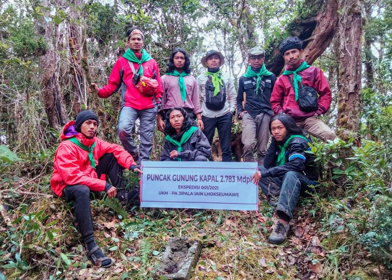
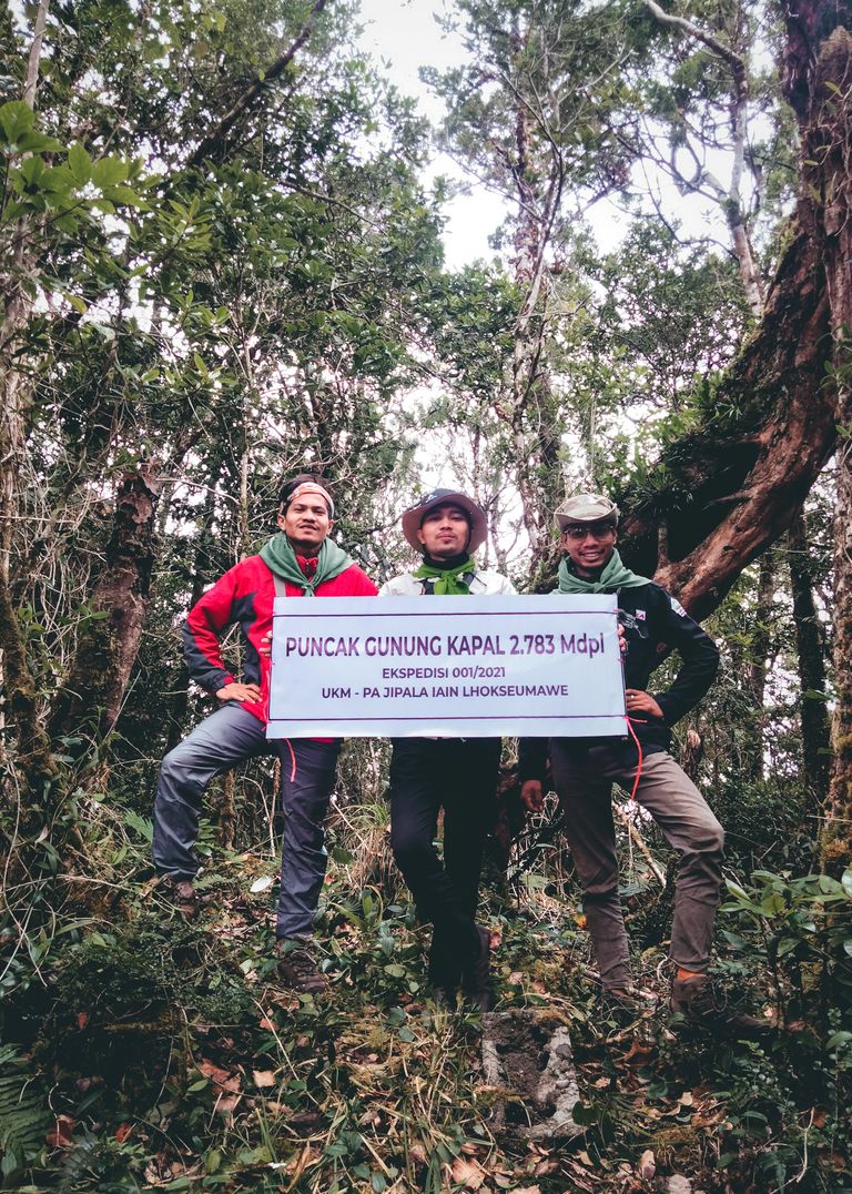
And finally, in an afternoon that was almost dark, after several days of rain and strong winds, the Elang Savana Team managed to reach the top of Mount Kapal at coordinates 04°49'31.62" N, 96°51'27.57" E at an altitude of 2,783 Masl
We happily celebrate the success but don't overdo it and immediately report the success to the monitoring team under us through Handy Talky (HT).
The ultimate goal of an adventure is not to reach the top, but to be able to return home safely and be reunited with loved ones.
A good journey is born of good planning, because mountains do not tolerate any form of unpreparedness.
Maybe this is a piece of my short story from a pleasant travel record.
Best Regard @arulchanrda
A very interesting work of connection with nature, being inspired by mountain energy is like recovering years of life. In #newvisionlife we value the content referring to everything that moves energy based on a better, healthier life, in connection with the natural and that this, in turn, allows us to live happily without thinking about age.
Receive a warm greeting and good vibes.