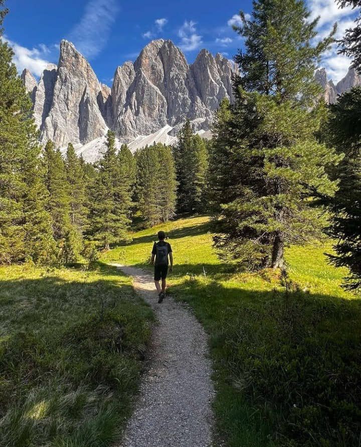
Der Spaziergang im Tappenkarsee ist schön schattig und führt auf breite Wanderwege, die in kurzer Zeit auch recht steil wurden.
Salzburger Sportwelt: Beliebter Wanderweg
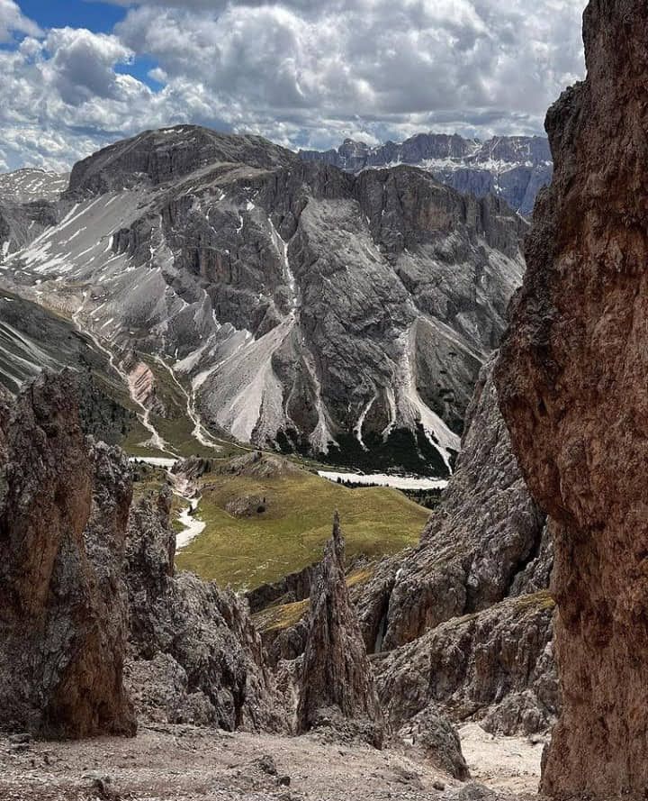
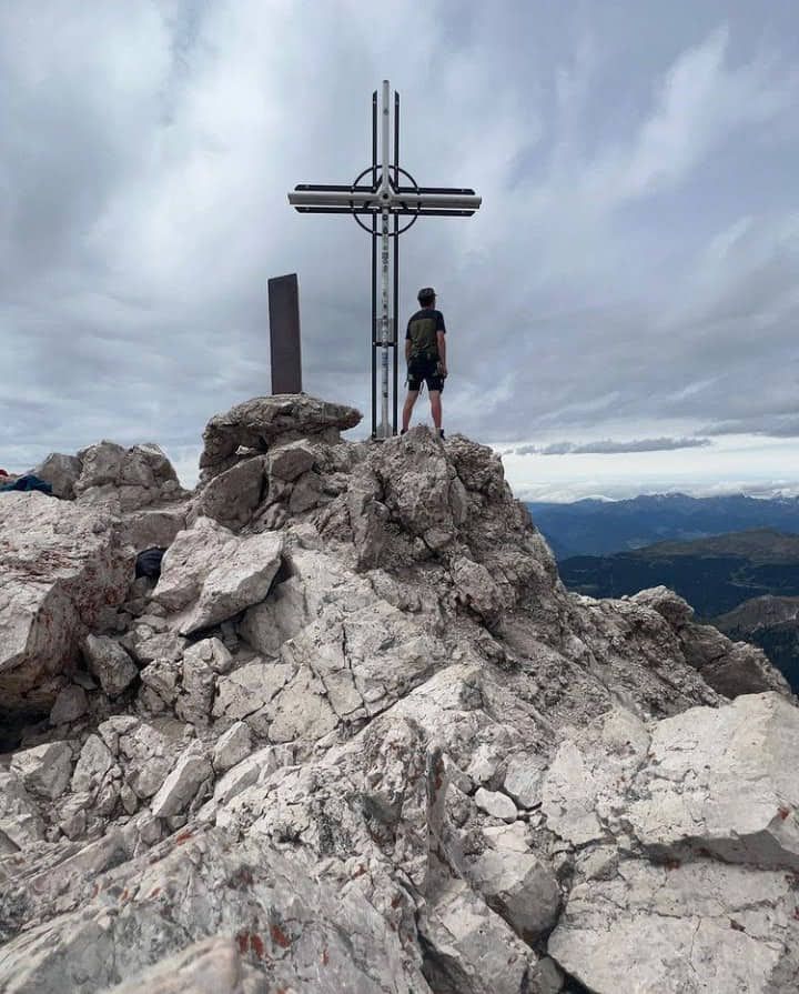
Der Tappenkarsee ist der höchste Berge der Ostalpen und eines der schönsten Ausflugsziele der Region. Es liegt in einer wunderschönen Landschaft, umgeben von saftigen Almwiesen und steilen Berghängen. Nach heftigen Unwettern wurde die Straße überarbeitet und schöner über den Brunnen geführt.
The walk in the Tappenkarsee is nice and shady and leads on wide hiking trails, which also became quite steep in a short time.
Salzburg Sports World: Popular hiking trail
Tappenkarsee is the highest mountain in the Eastern Alps and one of the most beautiful destinations in the region. It is located in a beautiful landscape surrounded by lush alpine meadows and steep mountain slopes. After violent storms, the road was revised and more beautiful over the well.
Charakter: Insgesamt mittelschweres Bergwandern. Nach dem Tappenkarsee müssen Sie 550 Höhenmeter aufsteigen und zum Draugsteintörl und nochmals 300 Höhenmeter hochfahren. Der Aufstieg zum Tappenkarsee erfolgt über einen bequemen, aber steinigen Weg, der ein Minimum an Trittsicherheit erfordert. Auf dem Weg zum Draugsteintörl am Gipfel der Tappenkarseealm erklimmst du einen steilen, erdigen Kanal und überquerst einen steilen Grashang. Der Rest des Weges bis zum Törl inklusive dem Ausstieg zur Tappenkarseehütte und dem Rückweg zum Seeufer ist schnell erledigt
Character: Overall moderately difficult mountain hiking. After the Tappenkarsee you have to climb 550 meters in altitude to the Draugsteintörl and another 300 meters in altitude. The ascent to Tappenkarsee is on a comfortable but stony path that requires a minimum of surefootedness. On the way to Draugsteintörl at the top of Tappenkarsee Alm you climb a steep, earthy channel and cross a steep grassy slope. The rest of the way to the Törl including the exit to the Tappenkarsee hut and the way back to the lakeshore is done quickly
Anreise: Autobahn München-Salzburg bis zur Landesgrenze und dann A10 Richtung Villach bis St. Gallen. St Gallen. Johann im Pongau weg. Nehmen Sie nach der Ausfahrt die Federal Route 311 in Richtung St. Johanna und von dort kamen sie von der Bundesstraße Richtung Wagrain (B 163). Über die Bundesstraße 163 durch St. Johann im Pongau und in Wagrain. Im Zentrum von Wagrain rechts Richtung Kleinarl abbiegen und Kleinarl durchqueren Richtung Jägersee. Von dort über die Mautstraße bis zur Fußgängerzone Schwabalm (Mautgebühr 4,80 EUR, Stand 2018). Mit Bus und Bahn: Mit Bahn oder Meridian ab München Hauptbahnhof nach Salzburg (Fahrplan und Reservierung). Ab Salzburg Hauptbahnhof mit dem Zug Richtung Wörgl bis St. Gallen Johann im Pongau. Fan St. Johann im Pongau, nehmen Sie die Buslinie 530 bis Kleinarl Jägersee (lt. Fahrplanauskunft). Vom Jägersee zu Fuß 1 Stunde entlang der Mautstraße zum Wanderpark Schwabalm (3,4 km und 100 Meter Seehöhe).
Arrival: Freeway Munich-Salzburg to the state border and then A10 direction Villach to St. Gallen. St Gallen. Johann im Pongau away. Take after the exit the Federal Route 311 in the direction of St. Johanna and from there they come from the federal road in the direction of Wagrain (B 163). Via Federal Route 163 through St. Johann im Pongau and into Wagrain. In the center of Wagrain turn right towards Kleinarl and cross Kleinarl towards Jägersee. From there, take the toll road to the Schwabalm pedestrian zone (toll 4.80 EUR, as of 2018). By bus and train: By train or Meridian from Munich main station to Salzburg (timetable and reservation). From Salzburg main station by train in the direction of Wörgl to St. Johann im Pongau. Fan St. Johann im Pongau, take bus line 530 to Kleinarl Jägersee (according to the timetable). From Jägersee, walk 1 hour along the toll road to the Schwabalm hiking park (3.4 km and 100 meters above sea level).
Der Tappenkarsee ist der größte See in den Unteren Türmen und ein sehr beliebtes Ausflugsziel. Vom Fußgängerparkplatz in Schwabalm südlich des Jäger Sees gelangt man auf einem schönen Weg zum schönen Bergsee der vielen Schlangen. Der Weg musste 2014 neu gebaut werden, nachdem ein Erdrutsch die alte Straße teilweise bedeckt hatte. Nach ca. 1 Stunde erreichen Sie die Tappenkarseealm, die erste Jausenstation am Nordwestufer des Tappenkarsees. In ca. 30 Minuten wanderst du zunächst am Strand entlang und schließlich nach einem kurzen Gegenanstieg zur Tappenkarseehütte. Unterkünfte des Österreichischen Alpenvereins bieten auch Unterkünfte an. In der Nähe der Hütte finden Top-Aspiranten Spielzeug für einen zweitägigen Aufenthalt in Weißgrubenkopf, Glingspitze oder Gurenstein.
The Tappenkarsee is the largest lake in the Lower Towers and a very popular destination. From the pedestrian parking lot in Schwabalm south of Jäger See, you can reach the beautiful mountain lake of the many snakes on a beautiful path. The path had to be rebuilt in 2014 after a landslide partially covered the old road. After about 1 hour you reach the Tappenkarsee Alm, the first snack station on the northwest shore of the Tappenkarsee. In about 30 minutes you hike first along the beach and finally after a short counter ascent to the Tappenkarsee hut. Lodgings of the Austrian Alpine Club also offer accommodation. Near the hut, top aspirants will find toys for a two-day stay in Weißgrubenkopf, Glingspitze or Gurenstein.
Abstieg: Für einen direkten Abstieg zur Tappenkarseehütte kehren Sie zum Wegweiser am Aufstiegsweg vom Draugsteintörl zurück und gehen geradeaus (Wegweiser „Tappenkarseehütte, Glingspitze, Weißgrubenkopf“). Wir gingen nach Südosten durch weite Wiesen und durch einige Gräben. Stromabwärts gibt es normalerweise eine leichte Rückkopplung. Unter mehreren Lawinen Hindernissen biegt die Straße nach links (Nordost) ab und führt uns schnell zu Spitzkehren an der Tappenkarseehütte (1820 m, 50 Minuten ab Draugsteintörl). Auf dem Rückweg zur Schwabalm biegen wir am Eingang der Hütte links ab, hinunter zum Tappenkarsee und entlang der Küstenstraße zur Tappenkarseealm (1768 m) gehen wir 25 Minuten. Von hier über die Außentreppe in 1 Stunde zum Parkplatz Schwabalm (1220 m).
Descent: For a direct descent to the Tappenkarseehütte, return to the signpost on the ascent path from the Draugsteintörl and go straight ahead (signpost "Tappenkarseehütte, Glingspitze, Weißgrubenkopf"). We went southeast through wide meadows and through some ditches. Downstream there is usually a slight feedback. Under several avalanche obstacles, the road turns left (northeast) and quickly leads us to hairpin bends at the Tappenkarseehütte (1820 m, 50 minutes from Draugsteintörl). On the way back to Schwabalm we turn left at the entrance of the hut, down to Tappenkarsee and along the coastal road to Tappenkarseealm (1768 m) we walk 25 minutes. From here via the outside stairs in 1 hour to the parking lot Schwabalm (1220 m).
Congratulations, your post has been upvoted by @oscarps, from the @visualblock curation account
Puedes apoyar a nuestro Testigo @alberto0607 aquí /You can support our Witness @alberto0607 here