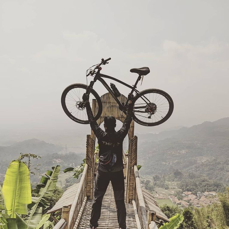
Good afternoon friends, everyone is blurry, how are you all, I hope everything is fine. Hey buddy, this is my second post on this blockchain so after 8 days ago I introduced myself on blurt, so today I'm back to posting here, for today I will post some photos of me and my friends relaxing at Mount Buleud Patrol, so this morning after we cycled together we had a moment to enjoy the beauty of this mountain.
ENJOY THE EXCELLENCE OF UP AND Descent ON THE XC TREK OF MOUNT BULEUD
The XC tracks around South Bandung seem to have never been explored, after previously I picked up the XC Sand Jereged - Alun Alun Soreang and Situ Cileunca - Gambung Argapuri tracks, now I will try to lift another track in South Bandung, namely the Gunung Buleud track which is located in Kutawaringin district. This track offers a combination of on-road and off-road trails as well as quite challenging climbs and descents. Apart from the tracks mentioned above, of course, there are many other tracks in the South Bandung area which have been explored by other riders who have not yet been exposed.
This track can be reached by several routes, all of which are along the Soreang-Cipatik highway, namely through the village roads of Cikopo, Jatisari or Cantilan. The first route is through the Cikopo village road which is not too far from the Bandung Regency Office Complex and Soreang Square, on this route we will pass an asphalt road in the middle of rice fields, the scenery is quite interesting. Although this route is closer to reaching Cipeundeuy village as the entrance to the Buleud Mountain track, through this route we will encounter many steep climbs that are quite draining of stamina to reach Cipeundeuy village. The second is to pass the Jatisari village road to Cibodas village before reaching Cipeundeuy village, through this route we will not encounter many climbs but this path is a bit far because it is a bit detour. The third route is through Cantilan - Pasir Jereged, this third alternative is a combination of the Pasir Jereged track and the Gunung Buleud track, the Pasir Jereged track ends at the Cibodas village road. As a variation, in Cibodas there are two options to reach the village of Cipeundeuy, you can follow the asphalt road uphill but the distance is shorter to the village of Cipeundeuy, or enter the single track irrigation route and the “silt route”. This path is further but more varied and challenging. For riders who live around West Bandung, they can reach the Mount Buleud track by walking along the Situwangi village road in the Cihampelas sub-district, West Bandung Regency, with the condition of the path with many fairly steep inclines.
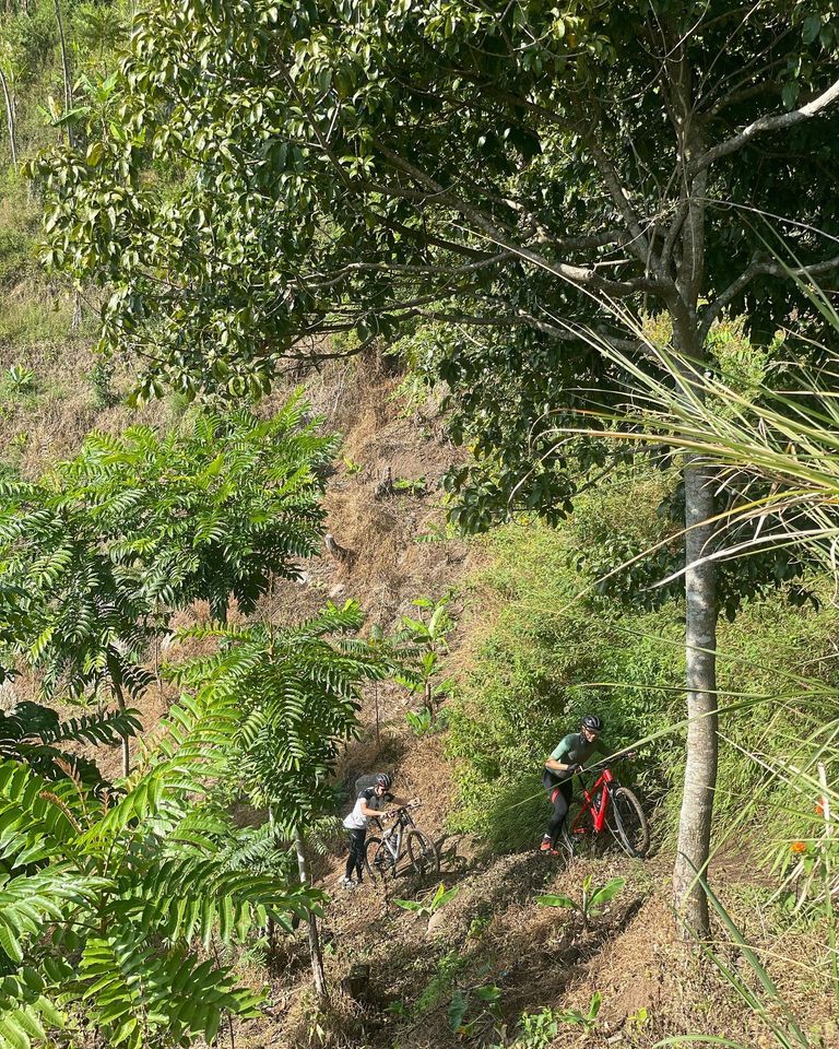
The uphill paths to Cipeundeuy village are actually more of a warm-up before we head to the Mount Buleud track, because our stamina will actually be tested when we enter the Cipeundeuy road to Gunung Buleud village. From the T-junction near SD Cipeundeuy we head north, after meeting a descent and we begin to face a varied uphill track which is quite long and drains our stamina. Starting with an incline on the asphalt path, at the end of the asphalt road the next incline in the form of macadam is ready to welcome us. After conquering the macadam incline which is accompanied by several sharp turns, we then find a horizontal path of about 100 meters, good enough to adjust our gasping breaths, because next we will face a single uphill track which is quite far to reach Gunung Buleud village, plus the sparse trees along the way. This path makes this path hot and arid. Riding or guiding a bicycle even in the middle of an uphill path plus the sting of the sun makes our stamina drain faster. After more than an hour, we struggled to conquer this track, including conquering the last incline where the left and right sides were overgrown with bamboo clumps, so we arrived at the village of Gunung Buleud. Here there is an intersection, we who enter from Cipeundeuy village come from the south, while to the north is the path to Situwangi village, Cihampelas sub-district. Our goal is the macadam path that leads east to the single track downhill. But first, we stopped at a shop near the T-junction, rested, recovered our stamina while filling our rumbling stomachs, as well as filling our water supplies, because the next track is still far enough to get to the finish point on the Jatisari village road.
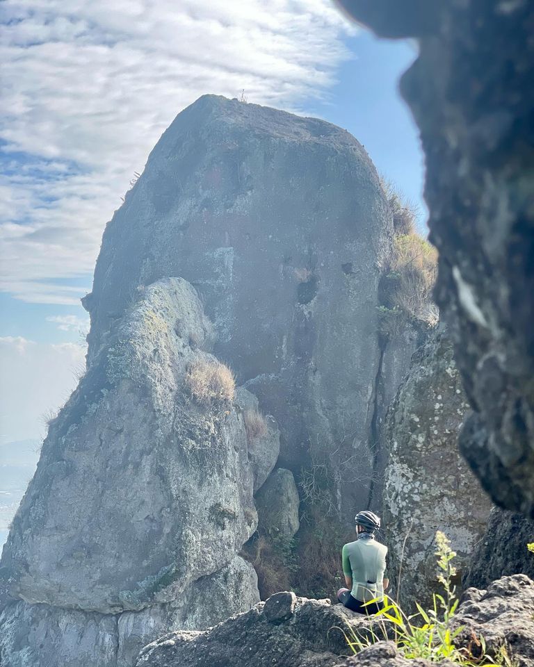
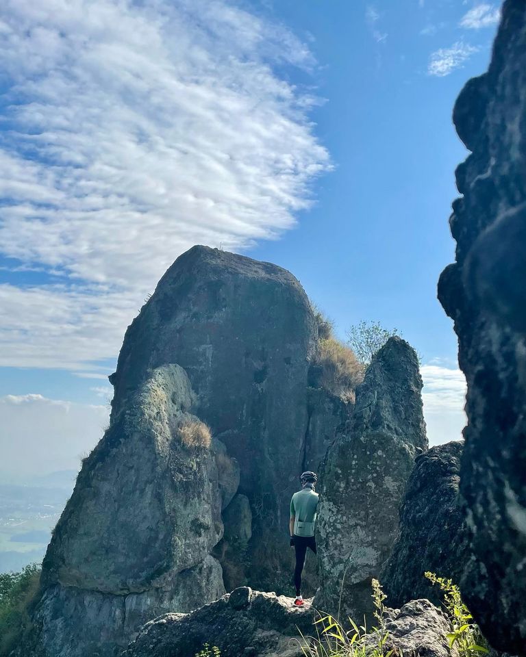
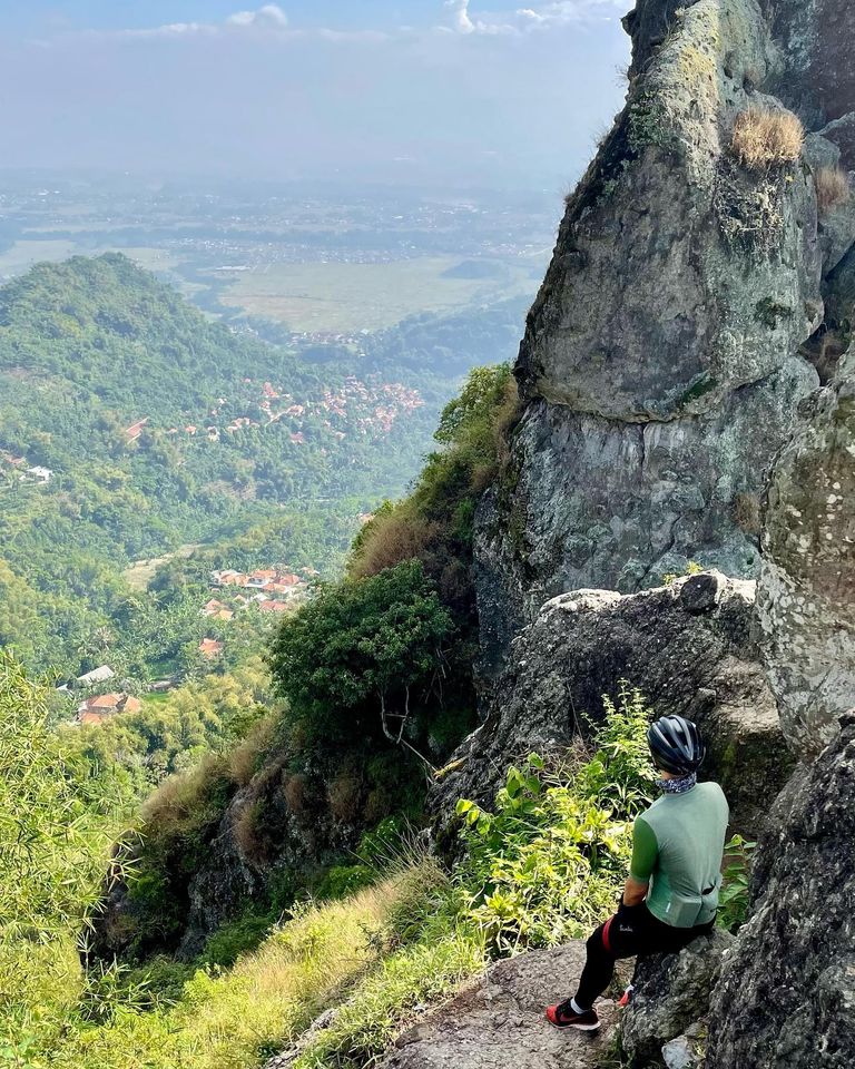
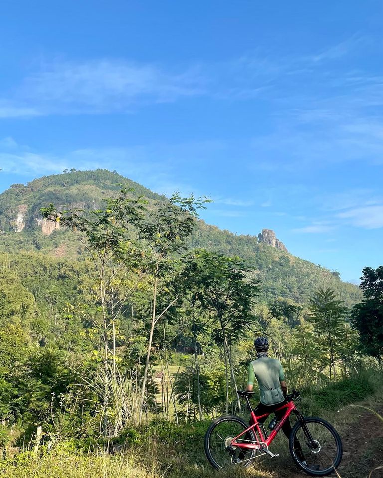
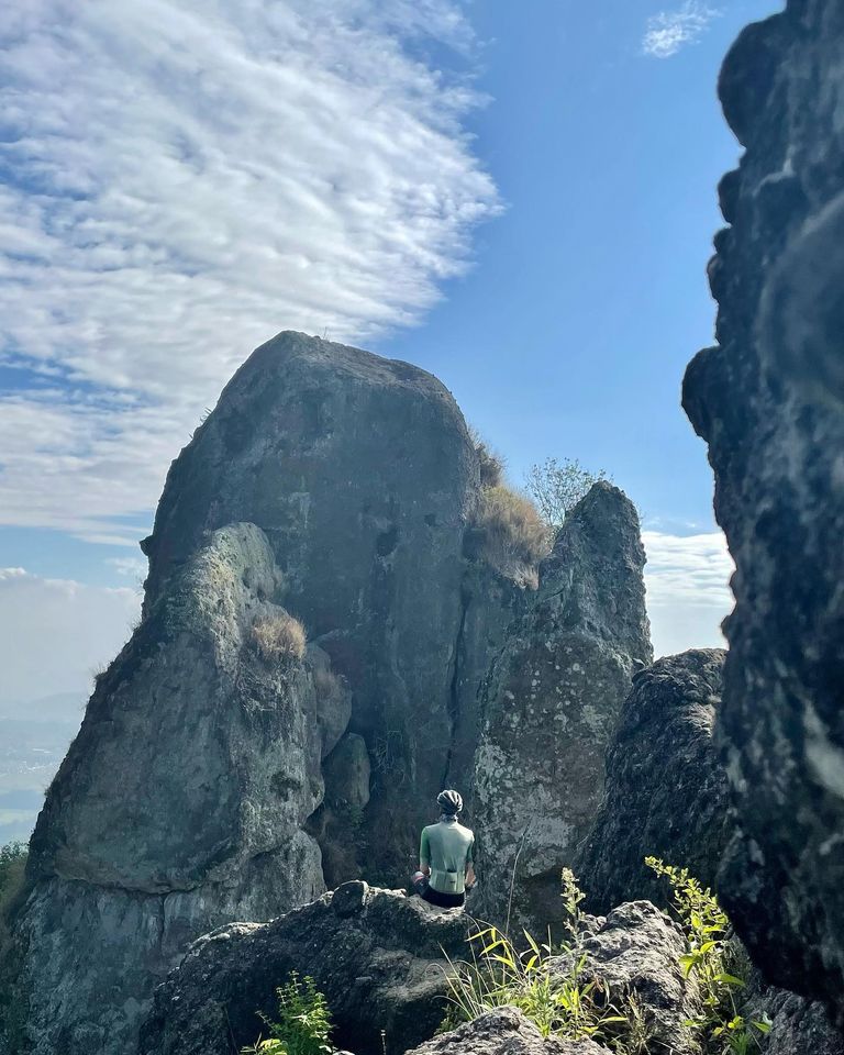
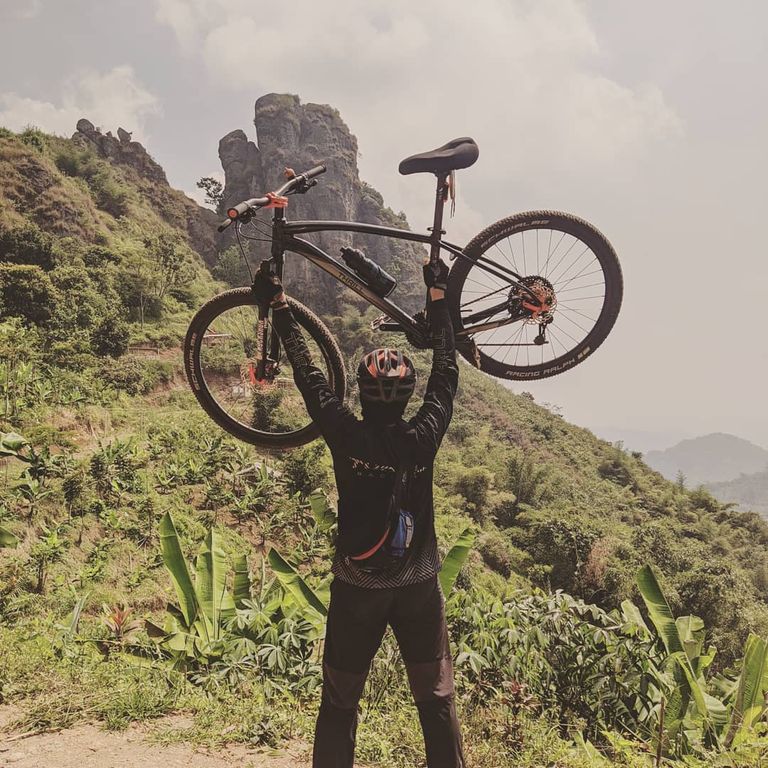
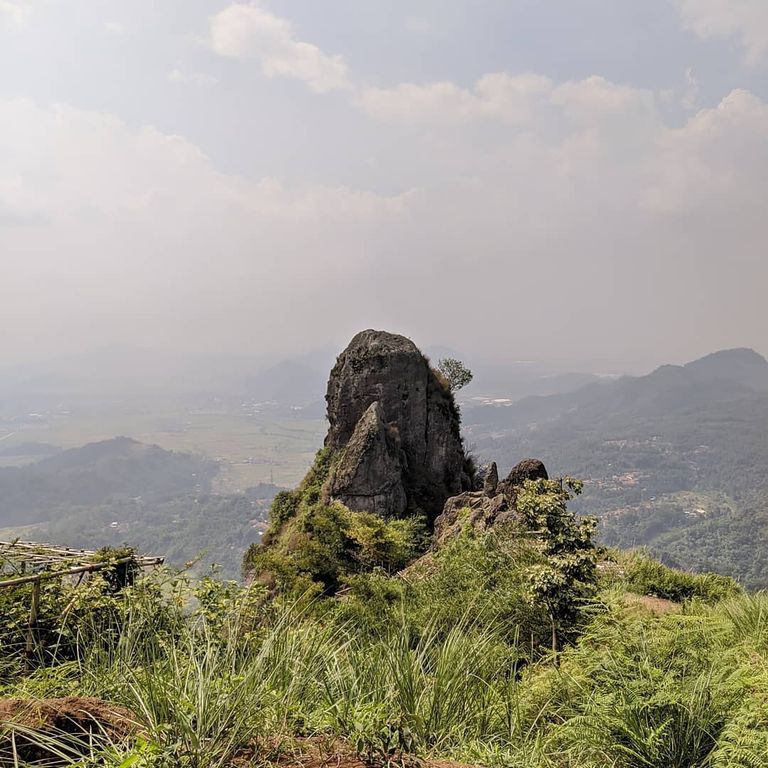
After resting enough and stamina has recovered, it's time for the journey to continue, the ride continues towards the macadam track, followed by a single track to the Bandung Regency - West Bandung border monument, one incline is blocking us before heading to the border monument. we meet, that if we pass this track during the rainy season, the weeds that grow to cover the single track can injure our feet and make our feet sore enough. Incidentally at this time it was dry, a lot of weeds had dried up, even in some places it looked like they had been burned, making this single horizontal track look wider. On our left, Mount Buleud rises with its stone walls, to the north the peak of Mount Buleud rises 2 large stones which the locals call Lawang Angin, in the distance stretches Saguling Lake as far as the eye can see, very beautiful. But we must quickly leave this presented beauty, a long and challenging descent awaits us. The dry and monorail-free downhill track (a trail in the form of an elongated hollow along the track, usually due to the scouring of two-wheeled vehicle tires) tempts us to push the bike through it, all the tiredness that had landed on the previous uphill track disappeared.
After more than 10 minutes we rode our bicycles on a downhill track, we again met an uphill path that would take us to the Makadam descent. At the end of the incline we can stop for a moment while enjoying the view of the rice fields and hills around Soreang. In the distance, the Si Starling Harupat stadium, the pride of the residents of Bandung Regency, stands majestically. The next trip is down the macadam track for approximately 1 km. It's also quite torturous when you pass it, making your hands and body sore, especially for those who ride hardtail/without rear suspension.
The end of this macadam track is an intersection. The east direction leads us to the single track down the hill towards Jatisari village, the north direction towards the single track which ends at Cantilan, which is the starting point for the XC Pasir Jereged track, the south direction is the single track downhill with some sharp turns which are also part of the track. XC Pasir Jereged track towards Cibodas village.
The direction we take is to the east, towards the hills which are overgrown with bamboo clumps towards Jatisari village as the finish point of this track. The downhill track on this hill is mostly straight with a few turns, good for speeding up our bikes. However, what must be remembered when entering this track is that there are lots of fallen bamboo tree branches scattered on the left and right of the track, losing alertness and concentration when passing through it can cause the branches to enter the RD of our bike and knock them out. It is also important to keep an eye on the bicycle in front of us to prevent this from happening, we can tell our friends in front of us if we see a twig sticking into the bicycle wheel. Another obstacle is the grass that grows thickly covering the single track, making it difficult for us to see what is in front of us, scattered stones, tree branches, or basins where water flows are ready to knock us down. But with full vigilance and concentration, we can race our bikes through this downhill track while completing our journey along the XC Gunung Buleud track.