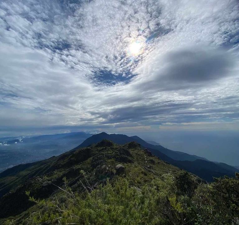
El Pico Naiguatá es el punto más alto del parque, con 2.765 metros sobre el nivel del mar. Se encuentra al noroeste de Caracas en las Montañas de Petare. La mejor forma de llegar a este sitio es tomar el camino cuya entrada está en El Marqués, al norte de La Julia. Naiguatá significa desembocadura del río Naigua, nombre que recibió la cabeza de familia de la madre del conquistador Fajardo. Desde la antigüedad, el nombre original Naiguatár o Naigua fue cambiado a Naiguatá, que es como se le conoce hoy en día. Su nombre también conmemora a la hermana del líder guaquerí Doña Isabel, madre del mestizo Francisco Fajardo
Pico Naiguatá is the highest point in the park, at 2,765 meters above sea level. It is located northwest of Caracas in the Petare Mountains. The best way to reach this site is to take the road whose entrance is in El Marqués, north of La Julia. Naiguatá means mouth of the Naigua River, a name given to the head of the family of the mother of the conquistador Fajardo. Since ancient times, the original name Naiguatár or Naigua was changed to Naiguatá, which is how it is known today. Its name also commemorates the sister of the Guaquerí leader Doña Isabel, mother of the mestizo Francisco Fajardo.
. Primera referencia
La primera referencia a este pico se debe a Humboldt, quien lo vio por primera vez en su camino de Cumaná a La Guaira, el 21 de noviembre de 1799. Durante uno de sus viajes, en 1816, reconoció que Naiguatá era superior a Sila. de Caracas. El monte Naiguatár y la Silla de Caracas son las montañas más altas de la costa de Venezuela. El primero llega casi a la cima del Cangó, una alta montaña del Pirineo francés, a 2.785 metros sobre el nivel del mar, y esta masa montañosa se vuelve muy grande, vista por primera vez desde la costa, y uno puede creer que podemos. vea los Pirineos o los Alpes que, despojados de su nieve, emergen del agua.
Originalmente, a principios del siglo XIX, se creía que Silla de Caracas era el punto más alto de la cordillera.
. First reference
The first reference to this peak is due to Humboldt, who saw it for the first time on his way from Cumaná to La Guaira, on November 21, 1799. During one of his trips, in 1816, he recognized that Naiguatá was higher than Sila. de Caracas. Mount Naiguatár and Silla de Caracas are the highest mountains on the coast of Venezuela. The former reaches almost to the summit of Cangó, a high mountain of the French Pyrenees, 2,785 meters above sea level, and this mountain mass becomes very large, seen for the first time from the coast, and one can believe that we can. see the Pyrenees or the Alps which, stripped of their snow, emerge from the water.
Originally, in the early 19th century, Silla de Caracas was believed to be the highest point of the mountain range.
El pico Naiguatá fue nombrado "Color" por Spence. Otros, como el grupo de excursionistas Adolf Ernst, que escalaron en 1879, le pusieron el nombre de "El Pelón". Spence describe esta ascensión en su libro "La Tierra de Bolívar", donde describe esta ascensión y muestra una imagen del camino que caminaron para conquistar la cumbre del Pico Naiguatá. Uno de los más famosos es el descubrimiento de un petroglifo en forma de un pájaro que intenta morderse la cola (que también se describe como un pequeño barco con su proa, que puede indicar la dirección de viaje en el mar). Esto lo encontraron en La Fila, entre Topo Galindo y Pico Naiguatá. Además, dijeron que podría ser el lugar donde solían rendir culto nuestros antepasados.
Naiguatá peak was named “Color” by Spence. Others, like the group of hikers Adolf Ernst, who climbed it in 1879, named it “El Pelón”. Spence describes this ascent in his book “La Tierra de Bolívar”, where he describes this ascent and shows a picture of the path they walked to conquer the summit of Pico Naiguatá. One of the most famous is the discovery of a petroglyph in the shape of a bird trying to bite its tail (which is also described as a small boat with its bow, which may indicate the direction of travel at sea). This was found in La Fila, between Topo Galindo and Pico Naiguatá. In addition, they said that it could be the place where our ancestors used to worship.
Después de eso, se realizan muchos otros viajes a las tierras altas de Naiguatá, donde se recolectan muchas especies (la mayoría desconocidas en Venezuela), y las plantas más importantes que crecen en Naiguatá. Por otro lado, la altura de la cima de la montaña varía respecto a la que conocemos hoy en día En uno de estos viajes, concretamente el quinto, el 5 de febrero de 1894, se informó de la existencia de escarcha sobre la hierba y la formación de hielo en un pequeño lago.
After that, many other trips are made to the highlands of Naiguatá, where many species are collected (most of them unknown in Venezuela), and the most important plants that grow in Naiguatá. On the other hand, the height of the top of the mountain varies from what we know today. On one of these trips, specifically the fifth one, on February 5, 1894, the existence of frost on the grass and the formation of ice on a small lake were reported.
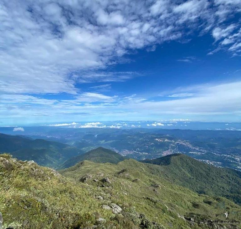
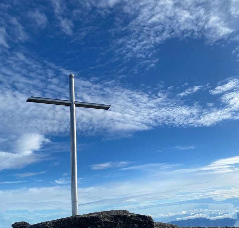
Aunque muchas personas que escalaron el Pico Naiguatá estiman su altura, fue Alfredo Jahn, el 18 de febrero de 1914, quien determinó su altura en 2,765 metros sobre el nivel del mar, en su recorrido Jahn demostró que desde la cima la vista puede alcanzar los 201 km. las islas de Los Roques y La Orchila, separadas por unos 140 km, pueden verse cuando las condiciones climáticas son buenas. La cruz que cubre la cima de la montaña.
Although many people who have climbed Naiguatá Peak estimate its height, it was Alfredo Jahn, on February 18, 1914, who determined its height at 2,765 meters above sea level. On his tour, Jahn demonstrated that from the summit the view can reach 201 km. The islands of Los Roques and La Orchila, separated by about 140 km, can be seen when weather conditions are good. The cross that covers the top of the mountain.
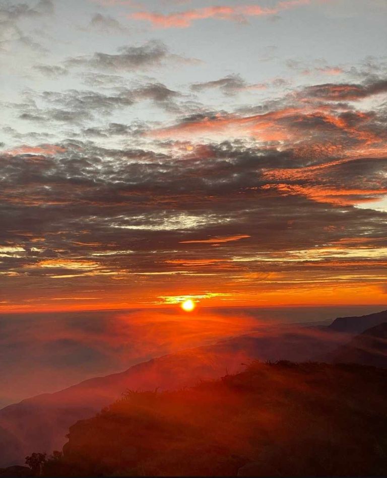
Fue colocado en el lugar el 25 de julio de 1954 por el célebre espeleólogo, investigador, administrador del parque y aventurero Ramón Hernández, apoyado por otras nueve personas, entre ellas su familia, que trabaja, sus amigos y el padre Francisco González, claretiano español. alto glaciar?
Como muchos expertos en este tema, incluido el Dr. Según Volkmar Vareschi (1955), la topografía de la montaña indica la presencia de antiguos glaciares. Prueba de ello es la presencia de rocas tipo morrena y el tipo de balsas que se pueden observar en algunos de los pequeños valles de La Fila, cerca de la cima de la montaña.
It was placed at the site on July 25, 1954 by the famous speleologist, researcher, park administrator and adventurer Ramón Hernández, supported by nine other people, including his working family, friends and Spanish Claretian Father Francisco González. high glacier?
According to Volkmar Vareschi (1955), the topography of the mountain indicates the presence of ancient glaciers. Proof of this is the presence of moraine-type rocks and the type of rafts that can be observed in some of the small valleys of La Fila, near the top of the mountain.
;
Lo anterior hará que durante algún tiempo la mayor parte del terreno de la Sierra de Avilan esté cubierta de hielo, y durante el año la temperatura en la línea debe ser inferior a 0 °C y en las laderas de la Cordillera debe hacer calor y calor. . . época del año, un manto de nieve blanca. Naiguatá es muy visitada
La ascensión al Pico Naiguatá es una de las más solicitadas y frecuentadas por ser el punto más alto de la montaña en la costa y estar alejado de Caracas o Petare. Es recomendable realizar una caminata más larga hasta el pico Naiguatá. ;La ascensión al Pico Naiguatá es una de las más solicitadas y frecuentadas por ser el pico más alto cerca de Caracas o Petare. Es recomendable dejar tiempo suficiente para ascender al Pico Naiguatá. ;
This will mean that for some time most of the terrain of the Sierra de Avilan will be covered with ice, and during the year the temperature on the line should be below 0 °C and on the slopes of the Cordillera it should be warm and hot. . . time of year, a blanket of white snow. Naiguatá is very visited
The ascent to Naiguatá Peak is one of the most requested and frequented for being the highest point of the mountain on the coast and being far from Caracas or Petare. It is advisable to take a longer hike to Naiguatá Peak. The ascent to Naiguatá Peak is one of the most requested and frequented because it is the highest peak near Caracas or Petare. It is advisable to leave enough time to climb Naiguatá Peak. ;
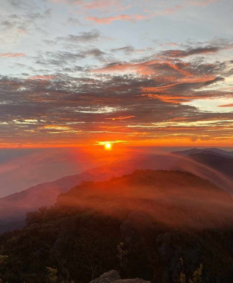
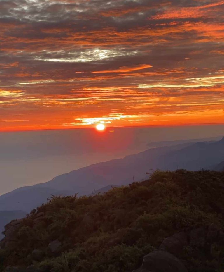
El Naiguatá representa una formación típica de roca y piedra ya que será lavada por la acción del tiempo, la lluvia y los fuertes vientos o el efecto de los cambios de temperatura que varían desde 2°C bajo cero hasta una máxima de 28°C sobre cero. Desde aquí se tienen las mejores vistas que ofrece el parque nacional, tanto en la capital como en la costa, se puede observar la vegetación del subpáramo, que recuerda a los páramos de los Andes. Pero, sin duda, una de las cosas que la hacen hermosa es la variedad de rocas, que viajeros y visitantes le han dado nombre a lo largo del tiempo. Entre otros:
;
The Naiguatá represents a typical formation of rock and stone as it will be washed by the action of time, rain and strong winds or the effect of temperature changes that vary from 2°C below zero to a maximum of 28°C above zero. From here you have the best views offered by the national park, both in the capital and on the coast, you can see the vegetation of the sub-páramo, reminiscent of the moors of the Andes. But, undoubtedly, one of the things that make it beautiful is the variety of rocks, which travelers and visitors have given it names over time. Among others:
La Piedra del Muñeco: una enorme roca con forma de seta parecida a la cabeza de una muñeca. Está diagonalmente opuesto al "Dinosaurio". ;
La Mariposa: la roca que aparece en la bajada del camino cerca del "Anfiteatro" tiene dos rasgos similares a las alas de una mariposa.
La fortaleza o el antiguo Castillo: la formación típica del valle vista desde la línea, rodeada de vegetación amarilla/verde que resalta la formación de oscuridad en el medio, dando una visión de esta fortaleza pero es una casa grande. ;
El Balcón: formación de grandes rocas combinadas, que continúa en una pendiente de 500 a 600 metros de profundidad.
;
La Piedra de la Muñeca: una enorme roca con forma de seta que se asemeja a la cabeza de una muñeca. Se encuentra en diagonal frente al «Dinosaurio». ;
La Mariposa: la roca que aparece en la bajada de la carretera cerca del «Anfiteatro» tiene dos rasgos similares a las alas de una mariposa.
La Fortaleza o el antiguo Castillo: formación típica del valle vista desde la línea, rodeada de vegetación amarilla/verde que resalta la formación oscura en el centro, dando una vista de esta fortaleza pero es una casa grande. ;
El Balcón: formación de grandes rocas combinadas, que continúa en una pendiente de 500 a 600 metros de profundidad.
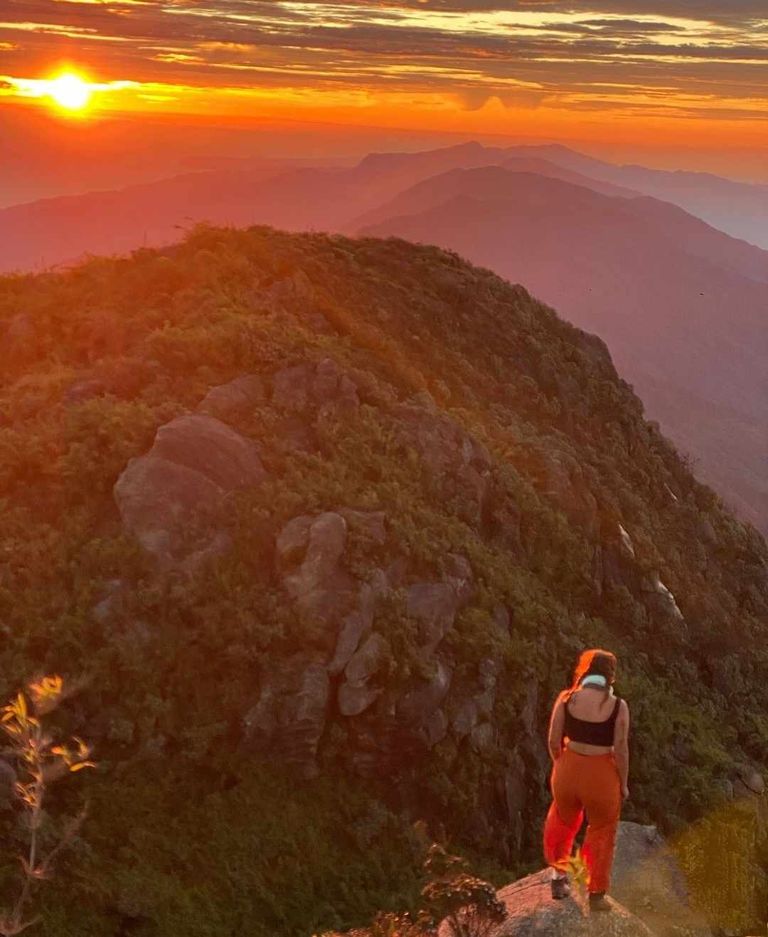
La Bañara: el piso está formado por grandes losas, muy bonitas que parecen un baño, y está en una línea cercana al encuentro de Petare. También se le llama "Panel de Piedra", por la cantidad de iniciales y nombres de los invitados pintados o grabados. Por su bella estructura también destacan las denominadas "Puerta Hércules" y "Peña Dorothy". ;
La Puerta de Hércules constaba de dos grandes columnas, una frente a la otra, la mitad de las cuales estaba al costado del camino; y la peña de Dorothy recibió este título para continuar la actuación de Dorita Muñoz Tebar, la venezolana que hizo por primera vez "La Travesía" escribiendo su nombre y el grupo que la acompañó en el color el día 25-26 de octubre.
La Bañara: the floor is formed by large slabs, very beautiful that look like a bath, and is in a line near the Petare meeting. It is also called “Stone Panel”, because of the amount of initials and names of the guests painted or engraved. For its beautiful structure also stand out the so-called “Puerta Hércules” and “Peña Dorothy”. ;
The Hercules Gate consisted of two large columns, one in front of the other, half of which was at the side of the road; and Dorothy's Peña received this title to continue the performance of Dorita Muñoz Tebar, the Venezuelan who made for the first time “La Travesia” writing her name and the group that accompanied her in color on October 25-26.

/ 47 “Passing” es el nombre que se le da al viaje habitual desde Asiento de la Silla hasta Pico Oriental, La Fila, para desde allí continuar hasta Pico Naiguatá. Esto se puede hacer en sentido contrario, primero subiendo hasta Naiguatá, donde pasarás la noche, y al día siguiente, temprano en la mañana, haciendo un viaje que finaliza en las montañas de Oriental de La Silla. En general, este método es menos común porque es más difícil y más largo que el otro. Un lugar favorito para acampar es el Anfiteatro (2.704 metros sobre el nivel del mar), llamado así por su área amplia, plana y circular, rodeada de picos de granito. Se trata de un pequeño valle o pradera bien resguardado del viento, y con capacidad suficiente para albergar muchas tiendas de campaña. A menudo se utiliza como lugar para acampar, porque está cerca de la cima (unos 15 minutos) y porque el agua está cerca del río llamado Stolk Spring.
;
/ Passing” is the name given to the usual trip from Asiento de la Silla to Pico Oriental, La Fila, to continue from there to Pico Naiguatá. This can be done in the opposite direction, first going up to Naiguatá, where you will spend the night, and the next day, early in the morning, making a trip that ends in the mountains of Oriental de La Silla. In general, this method is less common because it is more difficult and longer than the other. A favorite camping spot is the Amphitheater (2,704 meters above sea level), so called because of its wide, flat, circular area surrounded by granite peaks. It is a small valley or meadow well sheltered from the wind, and with sufficient capacity to accommodate many tents. It is often used as a camping site, because it is close to the summit (about 15 minutes) and because the water is close to the river called Stolk Spring.
Estos humedales, como los de la región de Naiguatá, son turberas, es decir, restos de plantas que se acumulan en lugares secos, cosas que hacen que muchas personas sean blancas y marrones que absorben agua y retienen agua. Durante la sequía, es muy importante saber que al cavar en esta bolsa saldrá el agua necesaria para los viajeros. Este manantial, conocido hoy como "Manantial Stolk", fue descubierto por el corredor Armando. Stolk Helmund, de ahí el nombre. Hay agua todo el año y cabe destacar que este es el único depósito de agua en esta zona alta, por lo que se recomienda mantenerlo limpio y no utilizarlo para lavar o bañar a las personas. Ahora, el coche que tienes. la ventaja de subir o bajar o desde lo alto del cerro de El Ávila, ahorrando unas 4 horas reales de caminata.
These wetlands, like those in the Naiguatá region, are peat bogs, that is, plant remains that accumulate in dry places, things that make many people white and brown that absorb water and retain water. During drought, it is very important to know that digging in this bag will come out the water needed for travelers. This spring, known today as “Stolk Spring”, was discovered by the runner Armando. Stolk Helmund, hence the name. There is water all year round and it is worth noting that this is the only water reservoir in this high area, so it is recommended to keep it clean and not use it for washing or bathing people. Now, the car you have. the advantage of going up or down or from the top of the hill of El Avila, saving about 4 real hours of walking.

El Topo Goering lleva el nombre de Anton Goering, ornitólogo, artista y naturalista, que acompañó a Spence en la primera ascensión al Pico. Naiguatá, el punto más alto de la Cordillera, y les advirtió que no descansaran en el lugar conocido como "Nido del Tigre" -hoy "Valle de las Tumbas"- por el riesgo de ser atacados por animales salvajes y -dar problemas-. En agradecimiento, el grupo decidió llamar al muelle "Punta Goering" o "Pico Goering", elevándose a 2.460 metros sobre el nivel del mar, el sitio que antes se llamaba "Rancho Grande" es EL. el edificio más grande de la zona, propiedad de Juan Gómez (altitud 1.860 m), donde podrás y descansarás. Juan Gómez es comisionado municipal y padre de nueve hijos; todos los chicos
El Topo Goering is named after Anton Goering, ornithologist, artist and naturalist, who accompanied Spence on the first ascent to Pico. Naiguatá, the highest point of the Cordillera, and warned them not to rest in the place known as “Nido del Tigre” -today “Valle de las Tumbas”- because of the risk of being attacked by wild animals and -making trouble-. In gratitude, the group decided to call the dock “Punta Goering” or “Pico Goering”, rising 2,460 meters above sea level, the site formerly called “Rancho Grande” is THE. the largest building in the area, owned by Juan Gomez (altitude 1,860 m), where you can and will rest. Juan Gómez is a municipal commissioner and the father of nine children; all of the boys