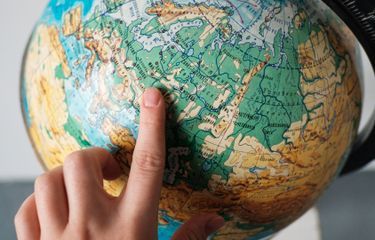
To see the location of several countries and continents on earth, of course, you need a map or a globe.
Both of them provide information about the existence of an area. Then what is the globe like?
Reported by the Encyclopaedia Britannica, a globe is a reduced image of the earth with a shape that is almost the same as the shape of the earth.
The globe is spherical, which can be rotated to make it easier to find a place or country.
Usually the globe is used for political purposes. Because with the globe it can be clearly delineated the boundaries of countries and big cities from countries in the world.
In addition, the globe is also used as a teaching aid in the world of education. This makes it easier for children to understand the image of the earth and planets in space.
In addition to these two uses, the presence of the globe is quite important as a source of knowledge. With a globe, you can describe the climate, vegetation, ocean currents, and other elements.
Use of globes
Globe can provide a variety of information, including:
Shows the true shape of the earth and shows its surface as a whole.
Shows the system of division of latitude and longitude and the size of the latitude circle clearly.
Shows the distance between longitudes. The closer to the poles, the shorter the lines of longitude, meeting and intersecting each other.
Demonstrating the occurrence of day and night
Demonstrating the earth's rotation
Identify geographic information on globe
The latitude and longitude of a globe are as follows:
Find a location with known latitude and longitude.
Knowing the climatic conditions of an area whose latitude is known.
Look for the time difference between one place and another with a different longitude.
history of the globe
The globe was first created by Greek astronomers in the 3rd century BC.
However, all the globes that are made do not describe the contents of the earth. The only surviving and almost resemblance is in the Farnese Atlas sculpture section.
Then, a globe depicting the entire old world was built in the Islamic world.
According to experts, one such example of a globe was introduced to Beijing by the Persian astronomer Jamal ad-Din in 1267.
The globe was later adopted into a globe made by Martin Behaim in 1492.
Behaim was a German mapmaker, navigator and trader.
Untuk melihat letak beberapa negara maupun benua yang ada di bumi, tentunya membutuhkan peta maupun globe.
Keduanya sama-sama memberikan informasi mengenai keberadaan suatu wilayah. Lalu seperti apakah globe itu?
Dilansir Encyclopaedia Britannica, globe merupakan gambaran bumi yang diperkecil dengan bentuk yang hampir sama dengan bentuk bumi.
Globe berbentuk bola, yang bisa diputar untuk mempermudah dalam mencari suatu tempat atau negara.
Biasanya globe dimanfaatkan untuk kepentingan politik. Karena dengan globe dapat tergambar jelas batas-batas negara dan kota besar dari negara di dunia.
Selain itu, globe juga digunakan sebagai alat peraga di dunia pendidikan. Hal ini mempermudah pemahaman anak-anak mengenai gambaran bumi maupun planet ruang angkasa.
Selain dua kegunaan itu, kehadiran globe cukup penting sebagai sumber ilmu pengetahuan. Dengan globe, dapay menggambarkan iklim, vegetasi, arus laut, dan unsur yang lainnya.
Penggunaan globe
Globe dapat memberikan bermacam-macam informasi, antara lain:
Menunjukkan bentuk bumi yang benar dan memperlihatkan permukaannya secara utuh.
Menunjukkan sistem pembagian garis lintang dan garis bujur serta besarnya lingkaran garing lintang secara jelas.
Menunjukkan jarak antargaris bujur. Semakin dekat dengan kutub, garis bujur semakin pendek, bertemu, dan saling memotong.
Memperagakan terjadinya siang dan malam
Memperagakan gerak rotasi bumi
Identifikasi informasi geografis pada globe
Garis lintang dan garis bujur dalam globe bertujuan sebagai berikut:
Menemukan lokasi yang telah diketahui garis lintang dan garis bujurnya.
Mengetahui keadaan iklim suatu daerah yang telah diketahui letak lintangnya.
Mencari perbedaan waktu antara satu tempat dan temoat lain yang berbeda letak garis bujurnya.
Sejarah globe
Bola bumi pertama kali dibuat oleh astronomi Yunani pada abad ke-3 Sebelum Masehi.
Namun, semua bola bumi yang dibuat tidak ada yang menggambarkan isi bumi. Satu-satunya yang bertahan dan hampir menyerupai ada di bagian patung Farnese Atlas.
Kemudian, globe yang menggambarkan keseluruhan dunia lama dibangun di dunia Islam.
Menurut para ahli, salah satu contoh bola bumi tersebut diperkenalkan ke Beijing oleh astronom Persia, Jamal ad-Din pada 1267.
Bola bumi tersebut kemudian diadopsi menjadi globe yang dibuat oleh Martin Behaim pada 1492.
Behaim merupakan pembuat peta, navigator, dan pedagang Jerman.