For years whenever I've been traveling on route 395 and I get to Bishop the massiveness of Mt. Tom would always catch my eye. And I would dream about someday climbing to the summit. Then last year I was talking with my mom and she told me she really wanted to climb it too. And so we planned the trip! So along with my uncle, cousin, and my moms friend Anne, we headed out to the Horton lakes trailhead just outside of Bishop. The road through the Buttermilk Hills was a little rough, but we made it just fine. Then we threw on our backpacks and started up the trail. The hike up followed an old mining road. We passed a few small cabins, passed through a big meadow, and then made the final climb up to Horton lake where there were some more old cabins and other old mining relics. Once everyone arrived at the lake we hiked around to the far side of it and found a great spot to setup our camp. Once camp was set I spent the rest of the day swimming and fishing in the lake and just hanging out around enjoying camp.
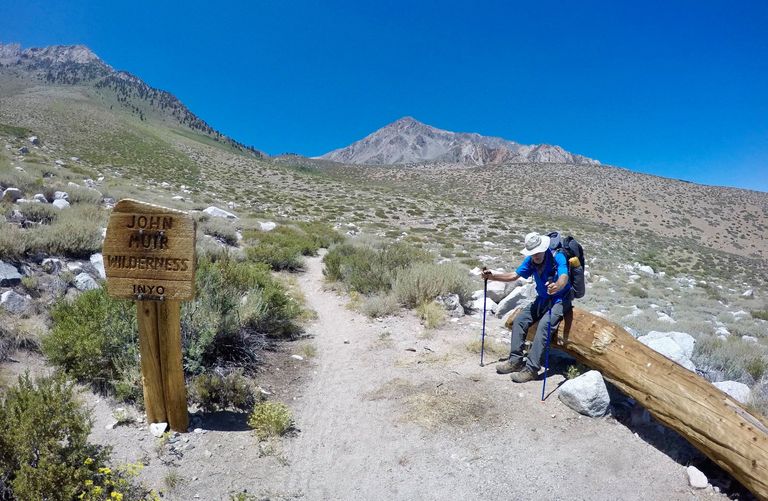
Horton Lakes trailhead
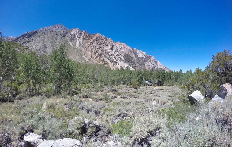
Hiking passed some old cabins

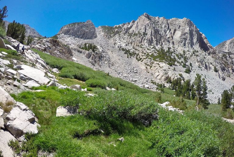
Views along the Horton lakes trail

Trout catching
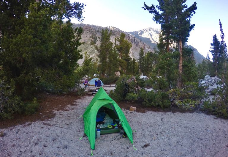
Camp
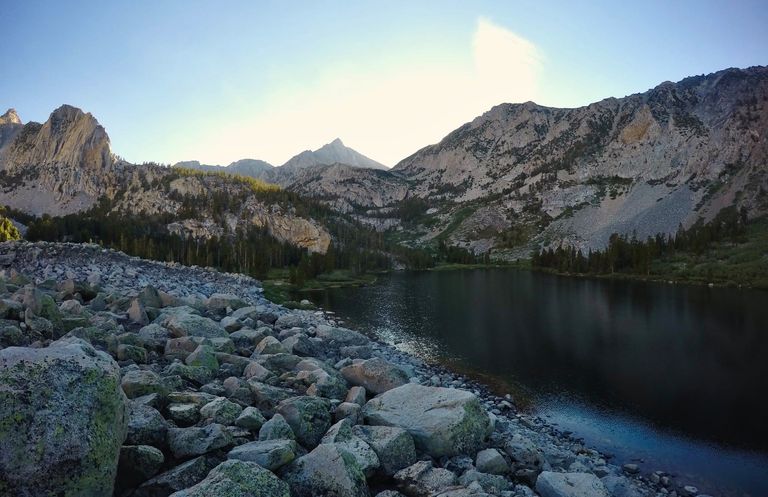
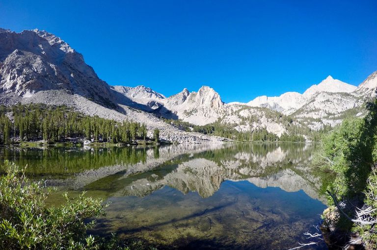
Evening at Horton lake
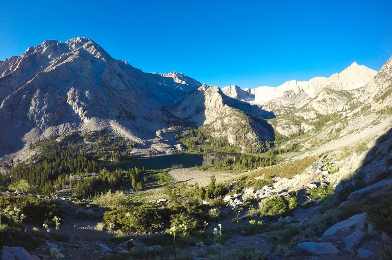
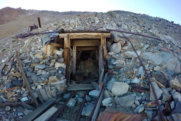
The next morning we got going early and started the big climb up to Mt. Tom. At first the trail continued following the old mining road as it switchbacked high above the lake. Then it crossed over the top of the ridge and dropped into the "Hanging Valley" where the road split. One way going to the Hanging Valley mine and the other going to the Tungstar Mine. We took the road to the Tungstar Mine. The mine itself was collapsed about 8 feet into the main entrance so I couldn't explore inside, but there was all kinds of really neat old mining relics all over. Tools, machines, giant cables... all kinds of cool stuff!
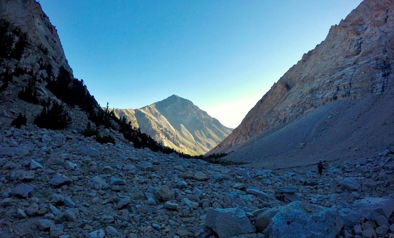
Climbing up above Horton lake

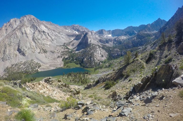
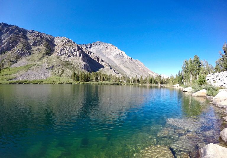
Basin Mtn. and Horton lake
Hanging Valley
Tungstar Mine
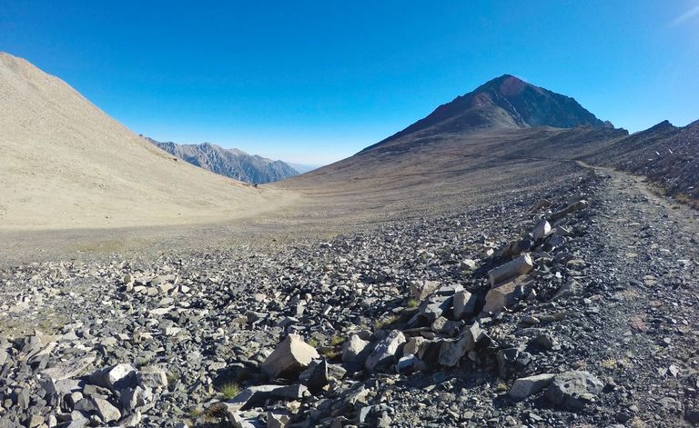
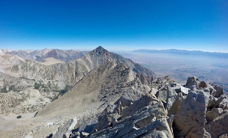
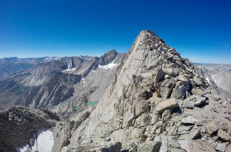
From the Tungstar mine we left the mining road and started the steep climb up to Mt. Tom. The steepness and the loose rock made it a brutal climb, but the incredible views from the summit made it all more than worth it!! From the peaks of the Palisades and the Evolution region in the south to the peaks of the Mono Divide to the north. We spent some time on the summit having lunch and just enjoying it all and then we started the steep climb back down to the mine. The loose rock made the descent a bit sketchy, but everyone made it down fine and then it was just an easy walk back down the old mining road to our camp at Horton lake where we stayed for another night.

Views from the top of Mt. Tom

Views from the top of Mt. Tom
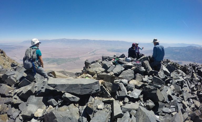
Enjoying the summit views

Mining relics at the Tungstar mine

Waiting for everyone to make it back down to the mine
Hiking back down to Horton lake
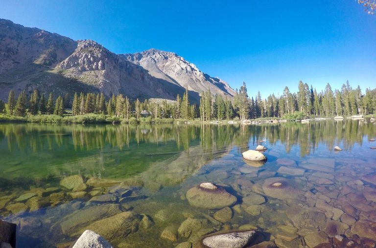
Horton lake
Evening at Horton lake
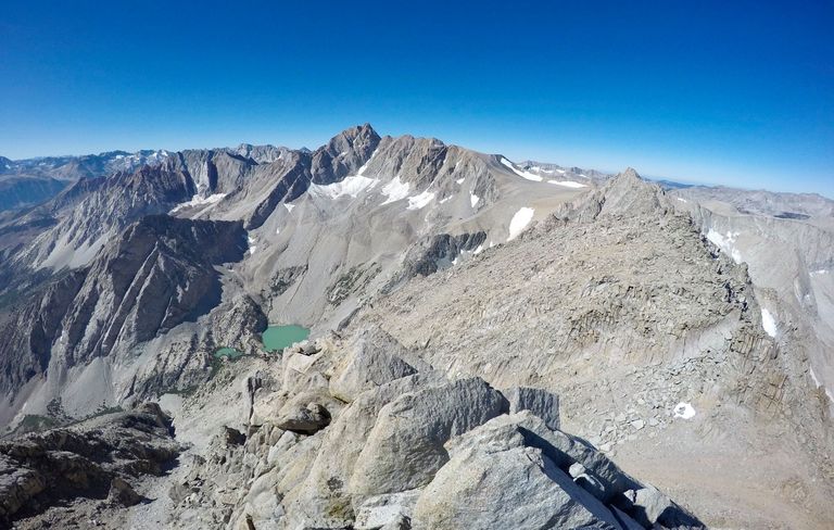
The next morning we got going early again. Mom, Anne, and I started making our way up to Basin Mtn. My uncle and cousin opted to do the shorter hike to Upper Horton lake instead. The climb up was mostly on talus but nothing that ever got to technical. We hiked up passed a small meadow and two small lakes and then made the final climb to the summit.
Starting our climb up Basin Mtn

Passing the lower lake
Arriving at from the summit
Although not quite as large of views as Tom they were equally incredible. Especially with the massive east face of Mt. Humphreys standing tall just to the south. We took some pictures and enjoyed the views for a bit and then started making our way back down. We got down to the upper lake and stopped there and had some lunch. Then we continued down passed the lower lake, the small meadow, and ultimately back to our camp at Horton lake for one final night.
Mt. Humphrey from Basin Mtn.

Me on top of Basin Mtn.
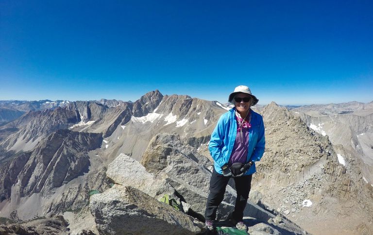
Mom on top of Basin Mtn.
Looking back at the summit of Basin Mtn.
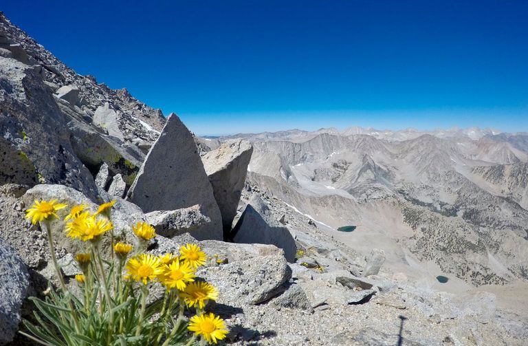
Wildflowers
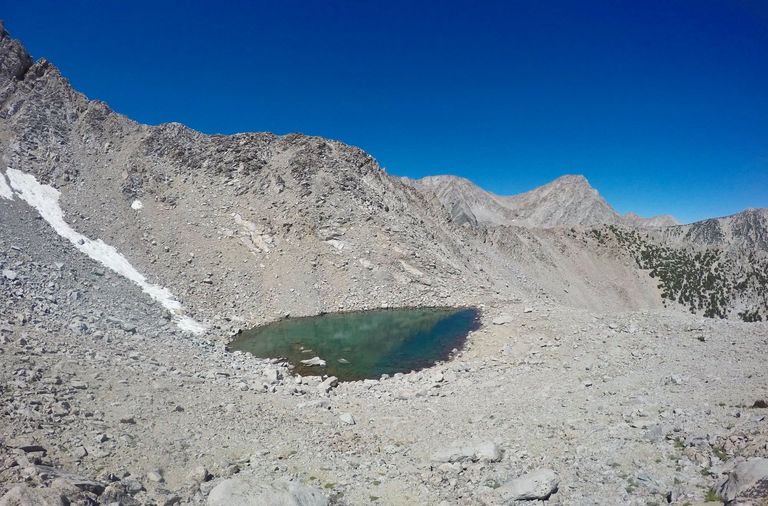
The upper lake
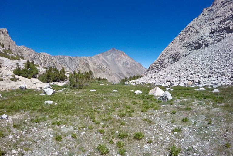
The small meadow
Descending back down to Horton lake
Back at Horton lake
The next morning we packed everything up and headed back down the trail to the trailhead wrapping up another awesome trip!
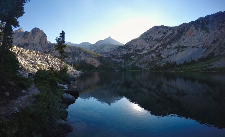
Morning reflection on Horton lake

Hiking back down the Horton lakes trail
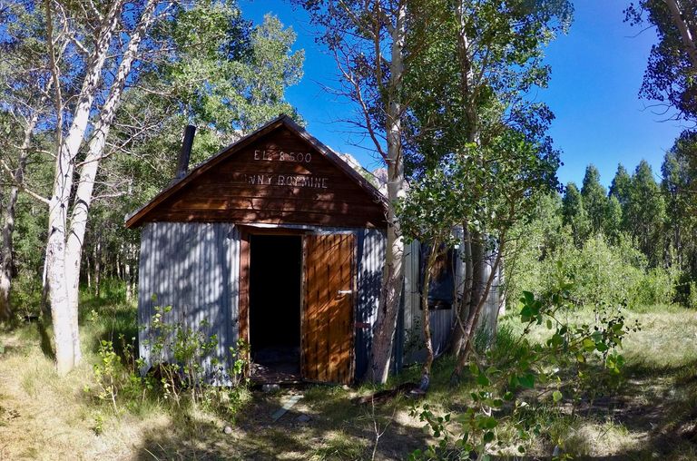
Old Cabins along the trail

Map (click to enlarge)
Until next time...
I hope you have enjoyed this glimpse into
My California!!
Contact me on Discord