(Picture: Spaarnestad)
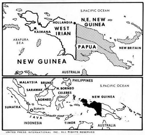
The picture above is a map of Indonesia when West Papua was still under Dutch rule. It can be estimated that this map dates back to the 1950s, when Indonesia was independent but West Papua was still under Dutch control.
The conflict between Indonesia and the Netherlands over West Papua peaked in 1958, when Indonesia expelled tens of thousands of Dutch and took over Dutch companies in Indonesia.
Currently West Papua has become part of Indonesia, but the bloody conflict has not left the Earth of Cenderawasih yet.