It is very difficult for visitors to the Andean Region to resist the temptation of travelling along the Route of the 7 Lakes.
Some decades ago, this stretch of road was not yet asphalted, and for that reason it was called Camino de los 7 Lagos (Road of the 7 Lakes).
Today it is a beautiful scenic route frequented by tourists from all over the world.
It is normally designed to be travelled going down from San Martín de los Andes towards Villa La Angostura, since all the viewpoints are located to the right if you choose this route.
In our case we preferred to do the opposite route. As we were visiting the Andean Region from Bariloche, we thought it would be a pity to speed through this route without stopping to get to San Martín de los Andes as soon as possible and from there, we could go down the road visiting all the lakes.
Therefore, as we drove up towards the mountain range, we normally stopped every 5-10 minutes, crossed the road even though there were no demarcation lines to do so, left the car and went down to the lake.
And we met many tourists doing the same route but coming down from the opposite side.
Other times we found a small space where we could leave the car without having to cross the road. But they are very few.
The road is in excellent condition and the only criticism at road level is the lack of adequate signage for those who go from Villa La Angostura to San Martin de los Andes and want to stop at the viewpoints without taking risks. Especially since there are an infinite number of bends.
Es muy difícil para quien visita la Comarca Andina substraerse a la tentación de recorrer la Ruta de los 7 Lagos.
Hace algunas décadas atrás este tramo de ruta no estaba todavía asfaltado y por ese motivo se lo llamaba Camino de los 7 Lagos.
En la actualidad es una hermosa ruta panorámica frecuentada por turistas de todo el mundo.
Normalmente está ideada para ser recorrida bajando desde San Martín de los Andes en dirección a Villa La Angostura ya que todos los miradores se encuentran ubicados a la derecha si se elige este recorrido.
En nuestro caso preferimos hacer el recorrido contrario. Como veníamos visitando la Comarca Andina desde Bariloche nos pareció una pena pasar velozmente este recorrido sin detenermos para llegar lo antes posible a San Martín de los Andes y desde alli si bajar con calma visitando todos los lagos.
Por lo tanto a medida que ibamos subiendo en dirección a la cordillera nos deteníamos normalmente cada 5-10 minutos, cruzábamos la ruta a pesar de no estar señaladas las líneas de demarcación para hacerlo, dejábamos el auto y bajábamos al lago.
Y nos encontramos con muchos turistas que hacían el mismo recorrido pero bajando de la parte opuesta.
Otras veces encontrábamos un pequeño espacio donde dejar el auto sin necesidad de atravesar la ruta. Pero son muy pocos.
La ruta está en excelentes condiciones y la única crítica a nivel vial es esa: la falta de una señalización adecuada para los que van desde Villa La Angostura hasta San Martín de los Andes y quieren detenerse en los miradores sin correr riesgos. Sobre todo porque hay una infinidad de curvas.
That said, we set off on our journey.
We set off from Bariloche and start driving along the historic Ruta 40. We pass Dina Huapi, a beautiful town on the shores of Lake Nahuel Huapi and arrive at the junction with National Route 237. We turn left and after 60 kms we arrive at Villa La Angostura.
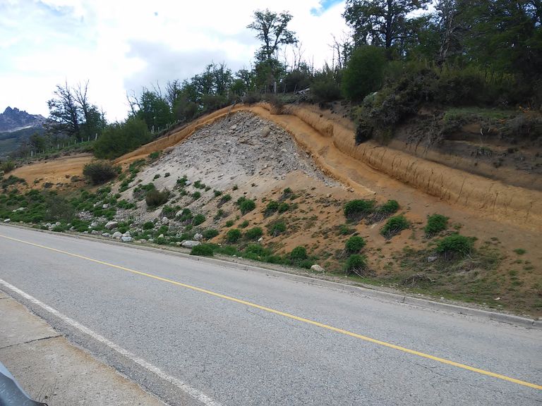
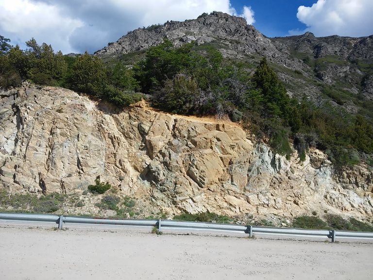
This stretch of road has nothing to do with what awaits us. It is the characteristic Patagonian steppe with little vegetation, low mountains and rounded peaks, flattened and in some cases even completely flat, rectangular, due to the erosive action of the winds over millions of years.
Dicho esto iniciamos el recorrido.
Salimos desde Bariloche y comenzamos a recorrer la histórica Ruta 40. Pasamos Dina Huapi, una hermosa localidad a orillas del Lago Nahuel Huapi y llegamos al cruce con la ruta nacional 237. Doblamos a la izquierda y después de 60 kms llegamos a Villa La Angostura.
Ese tramo de ruta no tiene nada que ver con lo que nos espera. Es la característica estepa patagónica con poca vegetación, montañas bajas y de picos redondeados, achatados y en algunos casos hasta totalmente planos, rectangulares, por la acción erosiva de los vientos a través de millones de años.
This marvellous route starts in Villa La Angostura. It is enough to name it to imagine a paradisiacal landscape of lakes, forests and unique trails.
For the inhabitants of this region it is simply the route that joins the towns of San Martín de los Andes and Villa La Angostura.
Or even more, it is a very particular section of Route 40, the main tourist corridor of the region, characterised by its unequalled scenic beauty and unique natural panoramic viewpoints that allow us to discover lakes, rivers and an endless number of attractions that open up to the tourist's sight.
Es a partir de Villa La Angostura que inicia esta ruta maravillosa. Es suficiente nombrarla nombrarla para imaginar un paisaje paradisíaco de lagos, bosques y senderos únicos.
Para los habitantes de esta región es simplemente la ruta que une las localidades de San Martín de los Andes y Villa La Angostura.
O más aún, un tramo muy particular de la Ruta 40, principal corredor turístico de la región caracterizado por su inigualable belleza paisajística y con miradores naturales panorámicos únicos que nos permiten descubrir lagos, ríos y un sin fin de atractivos que se abren a la vista del turista.
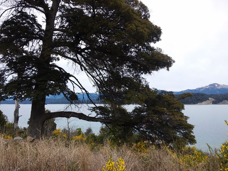
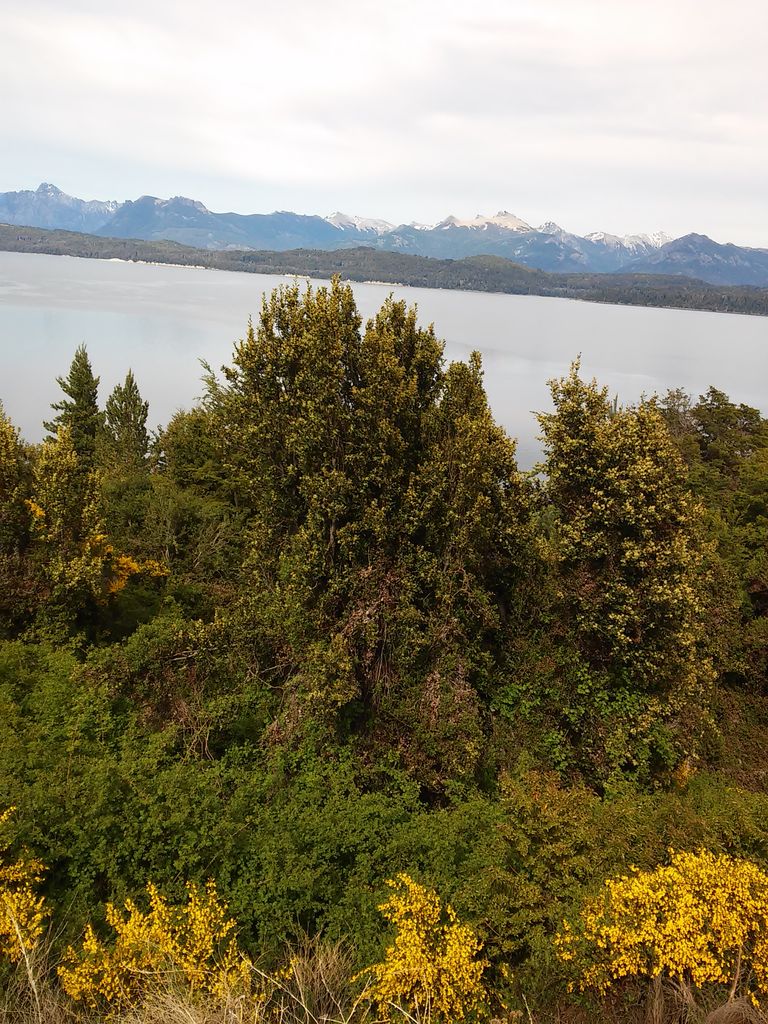
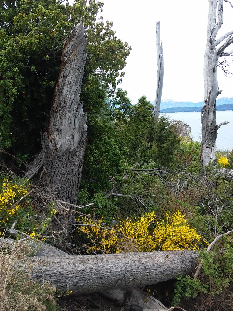
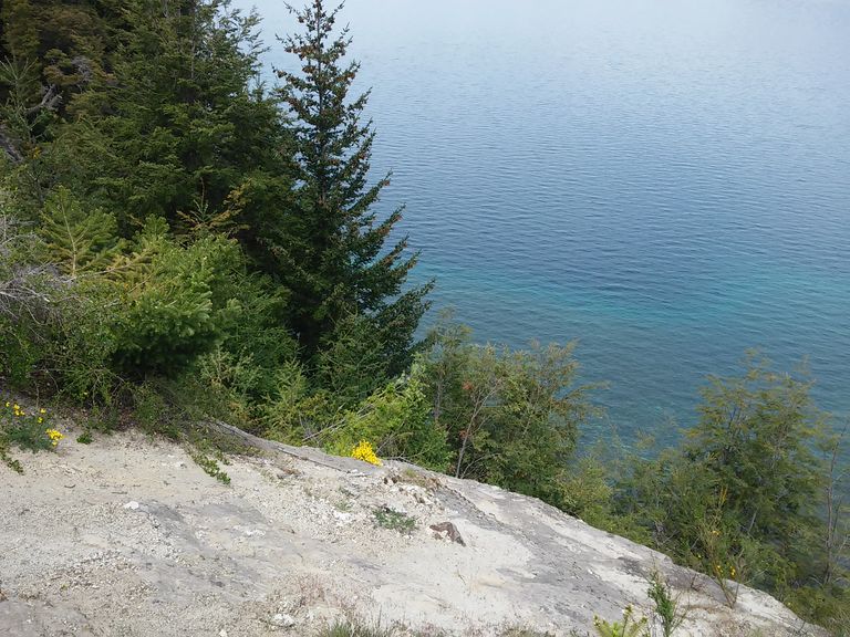
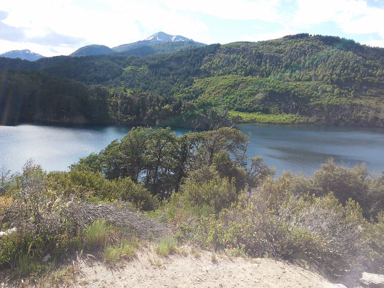
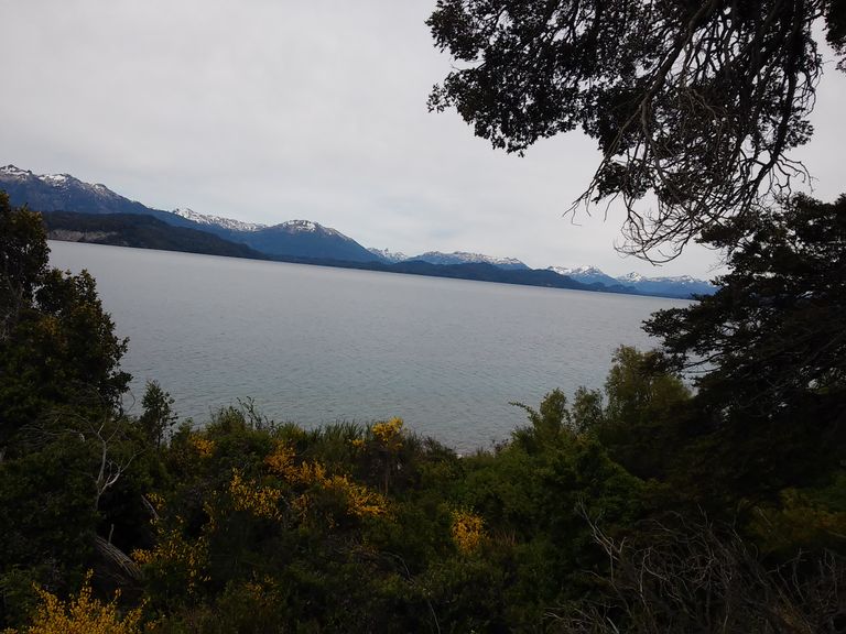
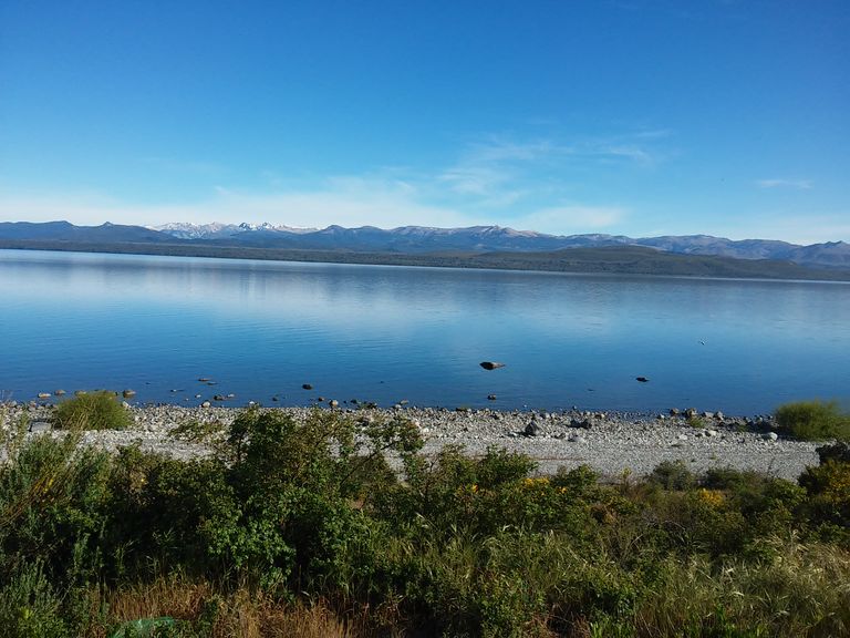
From the first viewpoints once past Villa La Angostura we can begin to admire the beauty of Lake Nahuel Huapí, one of the largest lakes in the world, which - in spite of not being an integral part of the smaller 7 Lakes - is an omnipresent element in the entire Andean region.
Its crystal-clear, transparent waters of glacial origin represent the final part of the route for those who walk down the 7 Lakes Route. For us it is only the beginning. And the presence of this true giant among the lakes of the Andean region only adds to the magic of the route.
Desde los primeros miradores una vez superada Villa La Angostura podemos comenzar a admirar la belleza del Lago Nahuel Huapí, uno de los más grandes del mundo, que -a pesar de no ser parte integrante de los 7 Lagos más pequeños- es un elemento omnipresente en toda la región andina.
Sus aguas cristalinas, transparentes de origen glaciar representan la parte final del recorrido de aquellos que recorren la Ruta de los 7 Lagos bajando. Para nosotros es solo el inicio. Y la presencia de este verdadero gigante entre los lagos de la región andina no hace sino aumentar la magia del recorrido.
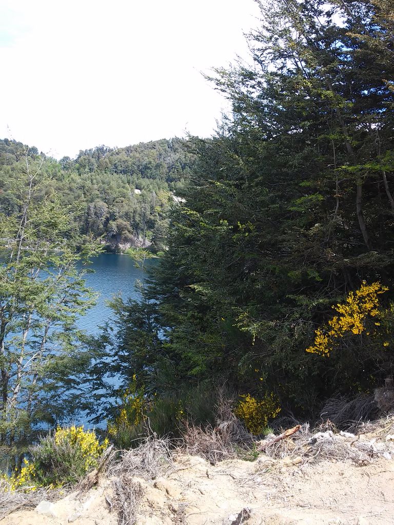
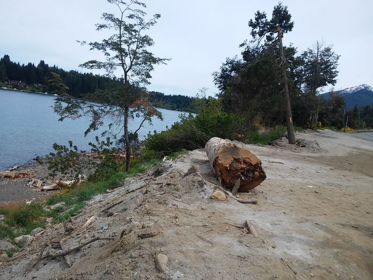
The first lake we find by the roadside after the Nahuel Huapí is the Espejo Lake and its tributary the Espejo Chico Lake.
Actually, you have to leave the road and take a gravel road for about 2 kms to find these two lakes.
There is a picnic and camping area, the only facilities for resting, but the adventure has just begun and tiredness is still a distant feeling.
Of all these lakes we will deal in detail later (when I speak in plural is because we made the trip for those who follow our previous posts who write, his wife and navigator mobile phone and Google Maps in hand and our permanent companion Zezé, the poodle toy that always accompanies us).
To describe all this beauty in a single post is impossible.
El primer lago que encontramos a la vera de la ruta después del Nahuel Huapí es el Lago Espejo y su afluente el Lago Espejo Chico.
En realidad hay que salir de la ruta y hacer por un camino de ripio cerca de 2 kms para encontrar estos dos lagos.
Hay un área de picnic y camping, únicas comodidades para descansar, pero la aventura recién comienza y el cansancio en una sensación todavía muy lejana.
De todos estos lagos nos ocuparemos en detalle más adelante (cuando hablo en plural es porque hicimos el viaje para quien siguen nuestros posts anteriores quien escirbe, su esposa y navegante celular y Google Maps en mano y nuestra permanente compañera Zezé, la caniche toy que siempre nos acompaña).
Describir toda esta belleza en un solo post es imposible.
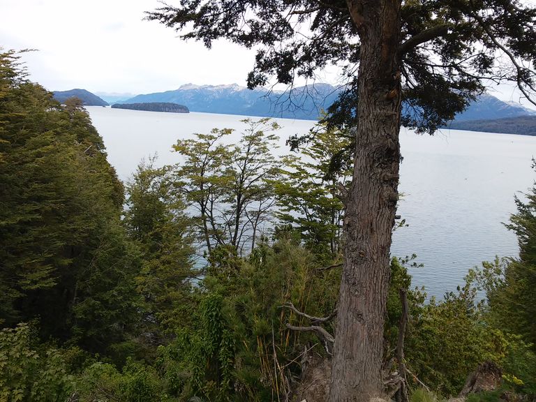
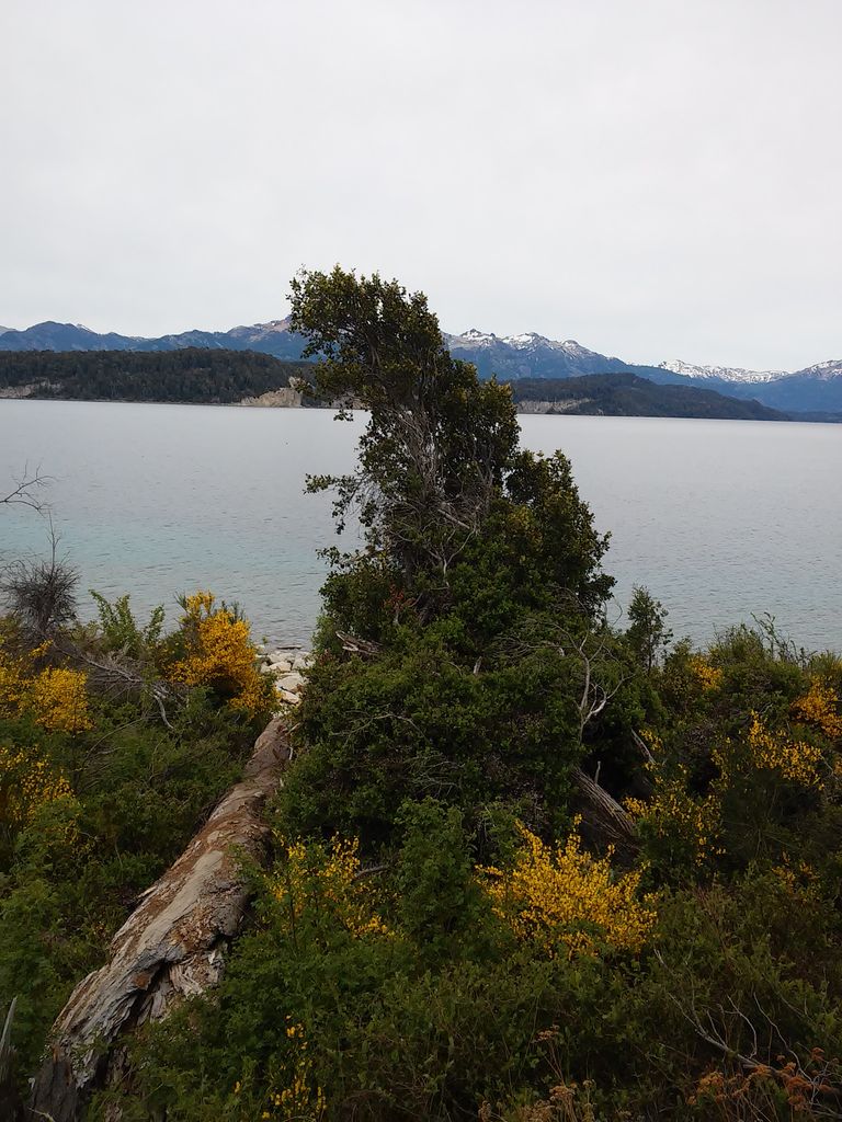
After a few kilometres we found the Correntoso Lake, and there we discovered that in this true labyrinth of lakes and viewpoints that is the Route of the 7 Lakes, it is the same lake that we had seen shortly after passing Villa La Angostura and that is mixed between two panoramic views of the Nahuel Huapi.
It owes its name to its quite agitated waters, as it is located inside a sort of bay between the mountains, which is affected by the wind and makes its waters quite agitated, unlike the other lakes, where the surface of its waters seems immobile.
Luego de pocos kms recorridos encontramos el Lago Correntoso, y ahí descubrimos que en este verdadero laberinto de lagos y miradores que es la Ruta de los 7 Lagos es el mismo lago que habíamos visto poco después de pasar villa La Angostura y que se mezcla entre dos vistas panorámicas del Nahuel Huapí.
Debe su nombre a sus aguas bastante agitadas ya que se encuentra dentro de una especie de bahía entre las montañas que sufre la acción del viento y hace que sus aguas sean bastante movidas, a diferencia de los restantes lagos donde la superficie de sus aguas parece inmóvil.
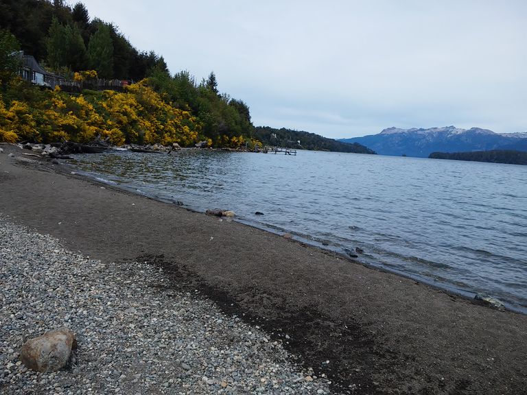
Lake Falkner is located right next to the road. It is not too low in relation to the road, so we assume that in times of high water levels due to snowmelt or heavy rains the water from the lake must flood this stretch of the road.
There is a wild camping site and this is the first fine sandy beach we have found in the whole region. Something strange since these beaches are characteristic of the Atlantic area and not of this mountainous area.
There are toilets, campfires, a grocery store, and it is open from November to April, it is very wild and natural.
Al Lago Falkner lo encontramos exactamente al lado de la ruta. No tiene un nivel demasiado bajo respecto a la misma por lo cuál suponemos que en época de crecidas como consecuencia del deshielo o de intensas lluvias el agua del lago debe llegar y supuestamente inundar este tramo de ruta.
Hay un camping agreste cy es la primera playa de arena fina que encontramos en toda esta región. Algo raro ya que estas playas son la característica de la zona atlántica y no de esta zona montañosa.
Hay baños, fogones, proveeduría, y se encuentra abierto de noviembre a abril, es muy agreste y natural.
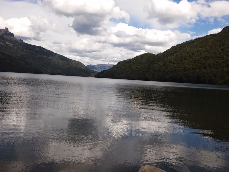
Very close to Lake Falkner is Lake Villarino. The stops between one viewpoint and another are very frequent and to a certain extent it is a route that can be done easily by bicycle if you are young and physically strong enough to do it.
In a car and doing it in the opposite direction, as in our case, we are sometimes forced to cross the road in front of a curve, taking the utmost caution when doing so, although the speeds on the 7 Lakes Route are not high.
It makes us want to stay here forever, but we still have other lakes to cross.
Needless to say, our tour is not limited to the route. This is what we present in this post.
However, the reality is that we went down to the lake, did a bit of trekking on the trails, photographed as much as we could and went on.
In the next posts you will see the results of these hikes and itineraries.
We don't stop for lunch. Backpack on our shoulders, sandwiches and soft drinks always within reach, we get into the car and continue to go deeper and deeper into a real earthly and natural paradise.
Muy cerca del Lago Falkner encontramos el Lago Villarino. Las paradas entre y otro mirador son muy frecuentes y en cierta medida es una Ruta que se puede hacer tranquilamente en bicicleta si uno es joven y tiene la suficiente fortaleza física para hacerlo.
En auto y haciéndolo en sentido inverso como es nuestro caso a veces nos vemos obligados a cruzar la ruta delante de una curva teniendo la máxima precaución al hacerlo, aunque las velocidades en la Ruta de los 7 Lagos no son elevadas.
Nos dan ganas de quedarnos eternamente en este lugar pero aún nos quedan otros lagos por recorrer.
De más está decir que nuestro recorrido no se limita a la ruta. Esto es lo que presentamos en este post.
Sin embargo la realidad señala que bajamos al lago, hacemos un poco de trekking en los senderos, fotografiamos todo lo que podemos y seguimos.
En los próximos podrán ver el resultados de estas caminatas e itinerarios.
No nos detenemos para comer. Mochila al hombro, sandwichs y bebidas sin alcohol siempre al alcance de la mano, subimos al auto e seguimos adentrándonos cada vez más en un verdadero paraíso terrenal y natural.
After four kilometres we cross the sign that marks the boundary between the Lanín and Nahuel Huapi National Parks, and we come across the Vuliñanco Waterfalls, a small natural wonder that sometimes goes unnoticed in front of an imposing and majestic natural environment.
Nevertheless, as we go from astonishment to astonishment contemplating the marvel of the lakes, we cannot help but stop to admire the panoramic view of its waterfall of about 35 metres that falls in two vertiginous arms due to an enormous stone that divides the waters and dilutes down the valley in numerous torrents and small streams that get lost down the valley in the tangled Andean vegetation.
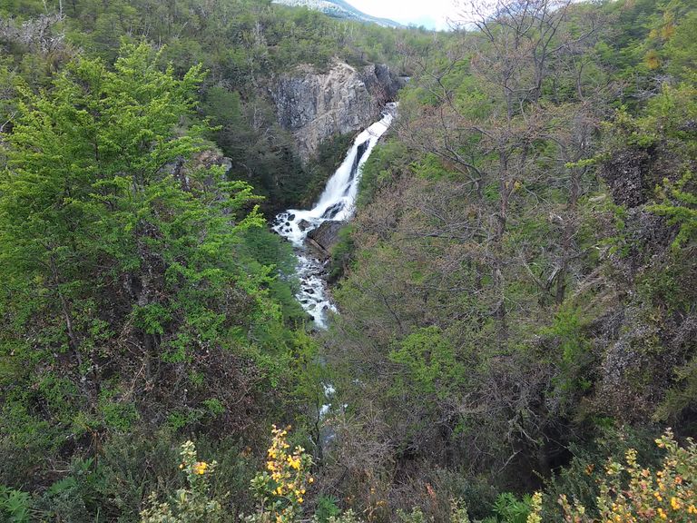
Después de cuatro kilómetros cruzamos el cartel que señala el límite entre los Parques Nacionales Lanín y Nahuel Huapi, y nos encontramos con las Cascadas de Vuliñanco pequeña maravilla natural que a veces pasa desapercibida ante un entorno natural imponente y majestuoso.
No obstante vamos de asombro en asombro contemplando la maravilla de los lagos no podemos dejar de detenernos para admirar panorámicamente su salto de agua de unos 35 metros que cae en dos vertiginosos brazos a causa de una enorme piedra que divide las aguas y se van diluyendo valle abajo en numerosos torrentes y ricahuelos que se pierden valle abajo en la enmarañada vegetación andina.
Noon has passed for several hours and we haven't even noticed. We are absolutely absorbed by the beauty of an enchanting landscape.
We make a detour from the road (about three kms) and we come across a lake surrounded by a jungle environment that covers the mountain slopes, together with the deep blue colour of its waters.
correntoso
It is the Lago Hermoso (Beautiful Lake) and we quickly understand the reason for its name. It has a camping site with basic amenities.
El mediodía ha pasado desde hace varias horas y no nos hemos dado cuenta. Hemos estamos absolutamente absorbidas por la belleza de un paisaje encantador.
Hacemos un desvío de la rura (aproximadamente tres kms) y nos encontramos con un lago rodeado por un entorno selvático que cubre las laderas de las montañas, junto a la coloración azul profundo de sus aguas.
Es el Lago Hermoso y comprendmeos rápidamente el porqué de su nombre. Tiene un lugar para acampar con las comodidades básicas.
We are approaching the end of our journey, which is San Martin de los Andes.
Ahead of us appears our penultimate lake, the second one for those who start from San Martin de los Andes, the Machónico Lake, with its spectacular natural viewpoint.
We think that we have done our journey in a very fast way. We feel like going back to continue printing unforgettable images in our retina.
We arrived in San Martín de los Andes and found no viewpoint of Lake Lácar. Surprise and apparent disappointment.
However, as soon as we arrived in the city we discovered why.
The viewpoints are inside the same city that enjoys this incredible privilege: Lake Lácar is inside the city itself.
The traveller departing from San Martín de los Andes does so bordering Lake Lácar, observing all its imposing beauty, and as he goes along a winding and curvy road, he leaves behind this real mountain village of the XXI century.
Llegamos a San Martín de los Andes y no encontramos ningún mirador del Lago Lácar. Sorpresa y aparente desilusión.
Sin embargo apenas llegados a la ciudad descubrimos el por qué.
Los miradores están dentro de la misma ciudad que goza de este increíble privilegio: el Lago Lácar está dentro de la misma ciudad.
Quien parte desde San Martín de los Andes lo hace bordeando el Lago Lácar observando toda su imponencia y a medida que se va avanzando por un camino de curvas y sinuoso se va dejando atrás esta verdadera esta aldea de montaña del siglo XXI.
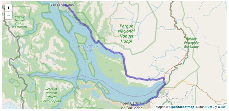
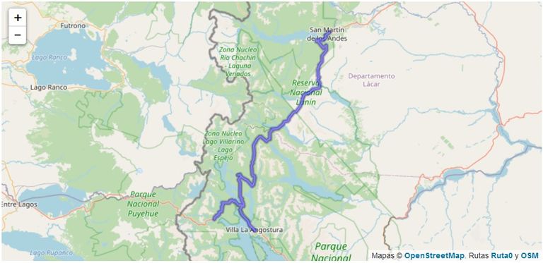
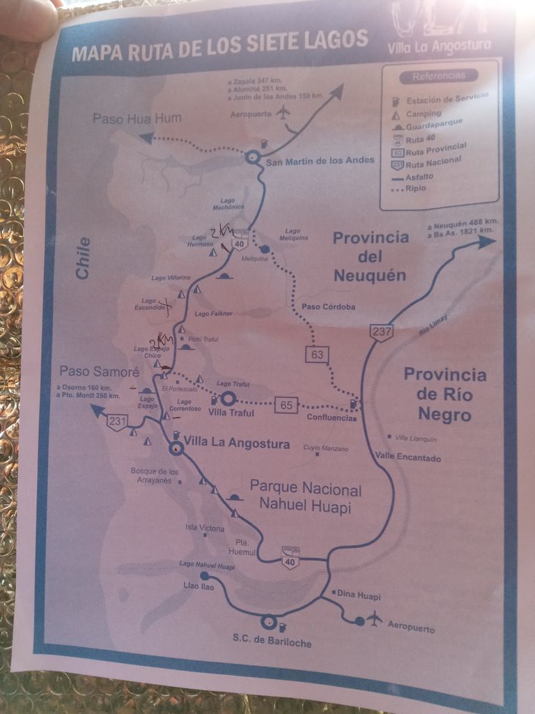
The maps illustrating this post are property of Ruta0
Los mapas que ilustran este post son propiedad de Ruta0
Thank you for supporting and manually curating my contents @epistem.