Caminata a las lagunas gemelas - Cima de la montaña.
Versión en español
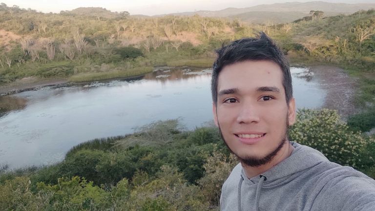
Hey, que tal amigos?, una vez mas en una pequeña aventura que quiero compartir con ustedes, visite un par de lagunas naturales que se unen cuando las temporadas de lluvias llegan a la zona, usualmente están secas gran parte del año, pero al momento de estar completamente llenas, el ecosistema a su alrededor cambia radicalmente.
Es como si nuevamente llegara la vida por primera vez, pues animales llegan a beber agua de aquí, aves anidan a los alrededores, los arboles reverdecen y crecen nuevas plantas.
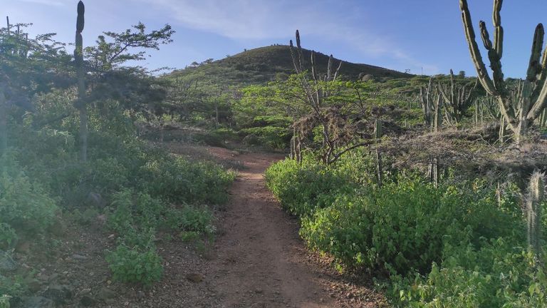
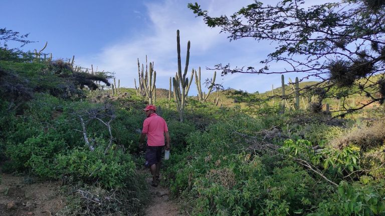
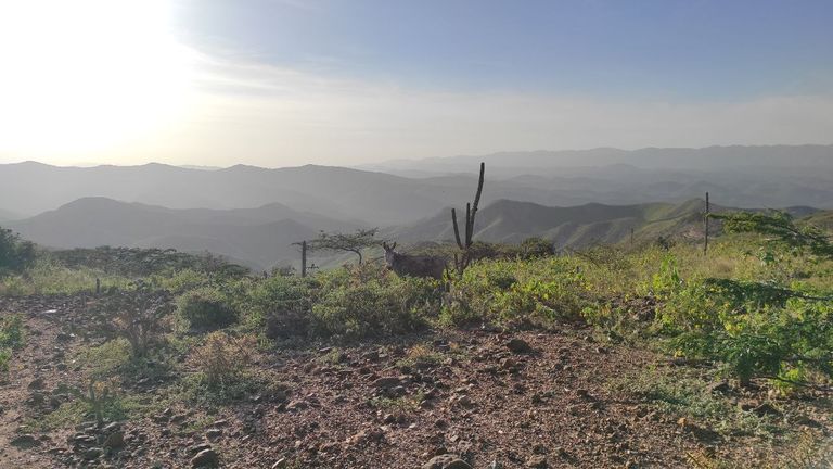
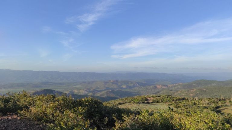
La caminata hacia acá es muy sencilla, el camino en realidad no tiene mucha dificultad y podemos tardar entre 40-50 min a un paso rápido pero constante , a lo lejos podemos ver montañas una tras de otras, y cada vez que caminamos hacia lo mas alto en el camino nos conseguimos con rocas gigantes, esto indica un cambio de terreno.
English version
Hey, what's up friends, once again in a little adventure that I want to share with you, I visited a couple of natural lagoons that come together when the rainy season arrives to the area, usually they are dry most of the year, but when they are completely full, the ecosystem around them changes radically.
It is as if life is coming back for the first time, as animals come to drink water from here, birds nest in the surrounding area, trees green up and new plants grow.
The hike here is very easy, the path is not really difficult and can take between 40-50 min at a fast but steady pace, in the distance we can see mountains one after another, and every time we walk to the top on the way we get giant rocks, this indicates a change of terrain.
Pinmapple link: [//]:# (!pinmapple 10.37836 lat -69.51578 long Hike to the twin lagoons - Top of the mountain. d3scr)
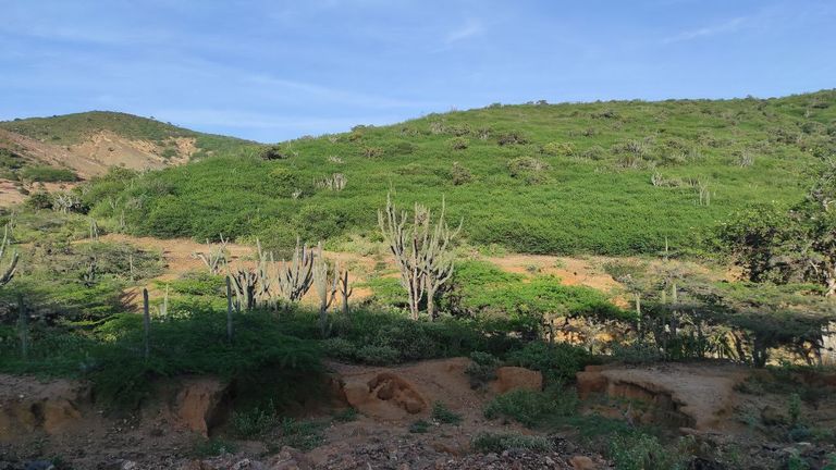
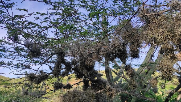
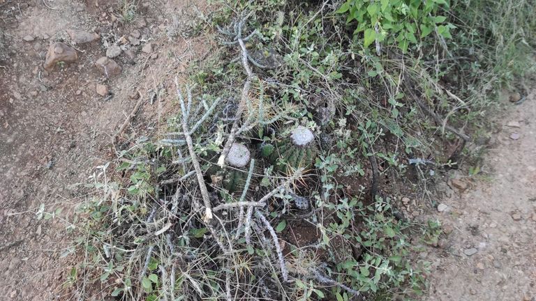
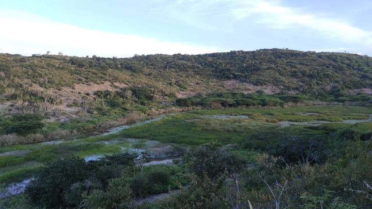
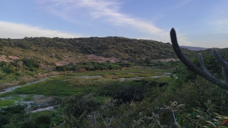
El ambiente es completamente semi árido, se pueden ver como en las montañas solo crecen plantas plantas xerófitas y adaptadas a este clima. Usualmente los cactus predominan en todo el lugar y las montañas pueden verse verdes pero en su mayoría son arbustos o matorrales que crecen en la época de lluvia, luego se secan y nuevamente la montaña se ve como si estuviese erosionada. Además el terreno es de este estilo suele cambiar conforme pasan los años, ya que es suelo arcilloso y arenoso.
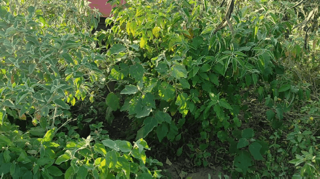
Por su puesto en la caminata debemos recorrer desde el pie de la montaña y cada vez que avanzamos se torna un poco mas inclinada, así que en algunas ocasiones recorremos un lugar donde hay abundantes plantas.
The environment is completely semi-arid, you can see how in the mountains grow only xerophytic plants and plants adapted to this climate. Usually cacti predominate throughout the place and the mountains can be seen green but mostly are shrubs or bushes that grow in the rainy season, then dry up and again the mountain looks as if it were eroded. In addition, the terrain of this style tends to change as the years go by, since it is clayey and sandy soil.
Of course in the hike we must walk from the foot of the mountain and each time we advance it becomes a little steeper, so sometimes we walk through a place where there are abundant plants.

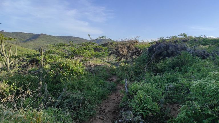
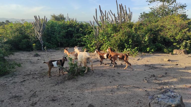
El trayecto el cual es un poco boscoso por así decirlo, donde atravesamos un camino con todo tipo de plantas al rededor es de10min, luego comienza el ascenso por la montaña, aquí hay senderos de piedra ya que en épocas de verano las lagunas almacenan agua que las personas del pueblo mas cercano utilizan para lavar e incluso beber. Es por ello que el sendero siempre se mantiene limpio, por donde caminamos no hay rastro de una planta, además que es el mismo camino que utilizan los animales, las personas que poseen grandes cantidades de crías suelen llevar los animales a la montaña para alimentarse.
The path which is a little wooded so to speak, where we cross a road with all kinds of plants around is 10min, then begins the ascent up the mountain, here there are stone paths because in summer times the lagoons store water that the people of the nearest town use to wash and even drink. That is why the trail is always kept clean, where we walk there is no trace of a plant, plus it is the same path used by animals, people who have large numbers of offspring often take the animals to the mountain to feed.


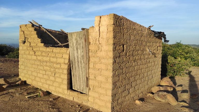
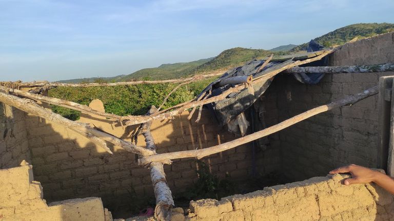
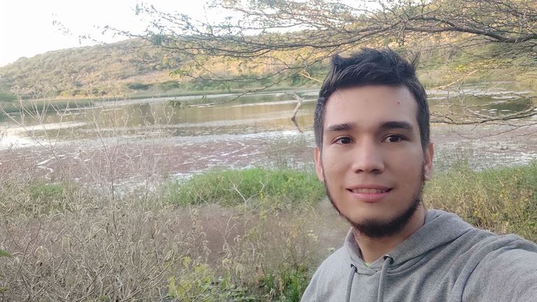
Finalmente en la cima vimos algunos animales, chivos, burros, ovejos y aves de la zona, al igual que lagartijas ya que abundan en esta zona por montones. Antes de llegar al lugar de las lagunas caminamos por los alrededores para ver las casas que estaban en pie la ultima vez que fui a este sitio que fue hace aproximadamente 2 años.
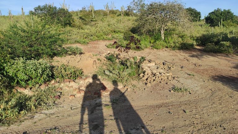
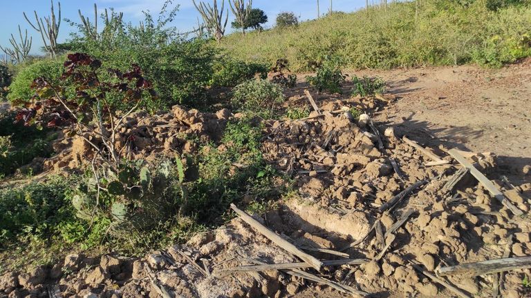
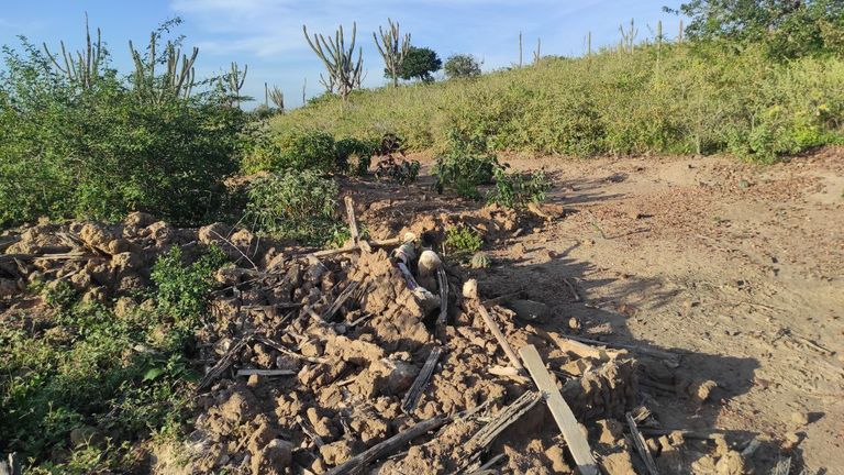
Casas abandonadas hace muchos años, ya que las personas que la habitaban se fueron a la ciudad y otros murieron, solo queda la fachada.
Una de ellas esta en e l suelo y queda muy poco, ya que aquí las casas son hechas de barro literalmente, es una mezcla entre barro y pasto, además que las columnas son de madera. Supongo que las lluvias eran tan fuertes que la derribaron, además en esta casa existía la creencia que habían almas en pena, y se practicaba "brujeria" ya que habían algunas imágenes en un cuarto cerrado.
Finally at the top we saw some animals, goats, donkeys, sheep and birds of the area, as well as lizards as they abound in this area in abundance. Before arriving at the lagoons we walked around to see the houses that were still standing the last time I went to this place, which was about 2 years ago.
The houses were abandoned many years ago, since the people who lived there went to the city and others died, only the facade remains.
One of them is on the ground and very little remains, since the houses here are literally made of mud, it is a mixture of mud and grass, plus the columns are made of wood. I guess that the rains were so strong that they knocked it down, also in this house there was the belief that there were souls in pain, and "witchcraft" was practiced since there were some images in a closed room.


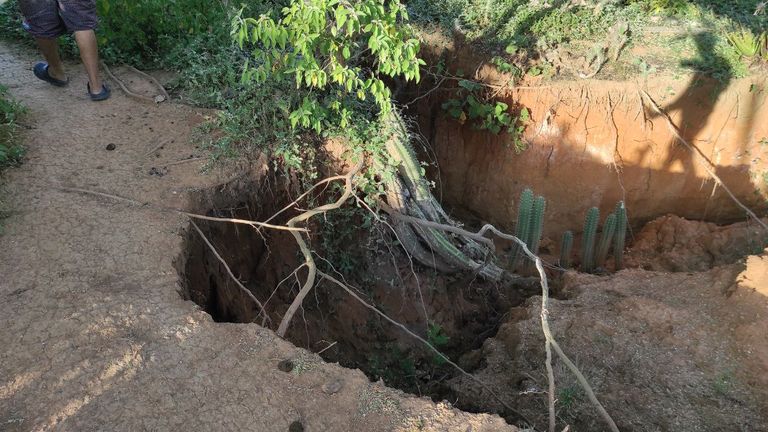
Mi anécdota mas tonta es que nos perdimos dos veces en el camino a las lagunas, y fue por que el camino estaba tan tapado que no encontrábamos la forma de llegar a la orilla, además que la cantidad de agua no era la esperada, era mucho mas de lo normal y el camino mas rápido estaba lleno.
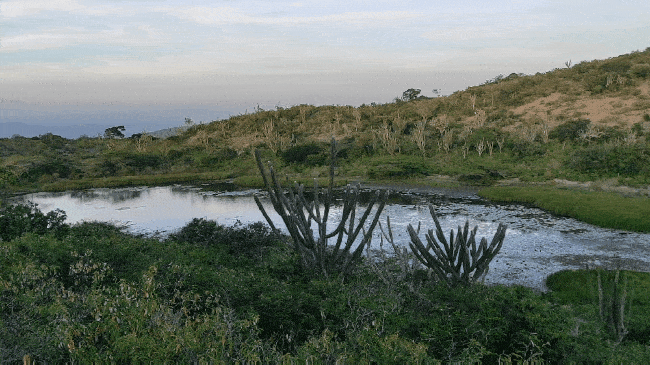
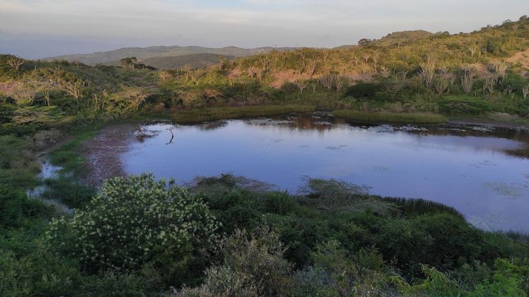
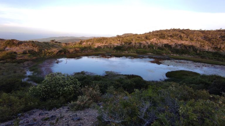
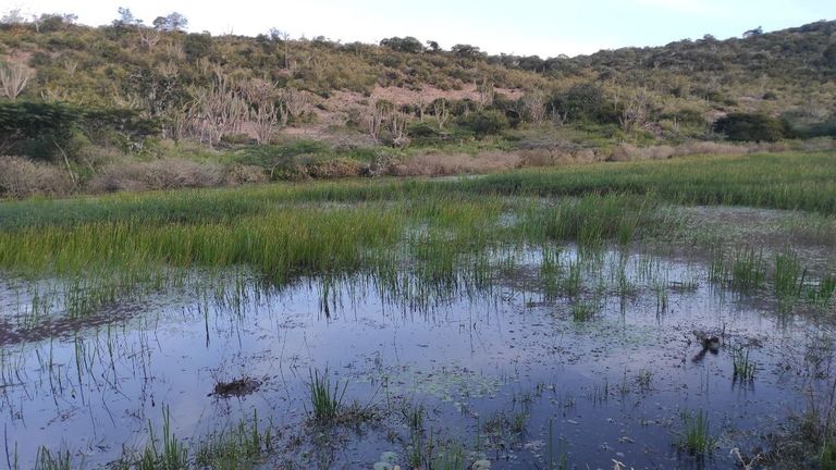
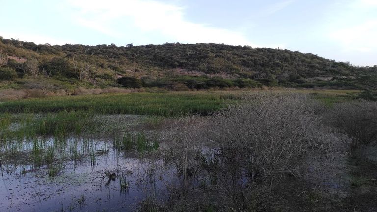
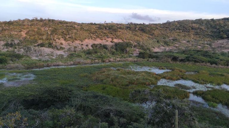
El agua estaba un poco sucia, había mucha maleza al rededor y plantas acuáticas, patos y garzas. El amiente era realmente hermoso, no se oía ruido alguno mas que el de la naturaleza, todo se sentía tan calmado.
Tuvimos que caminar nuevamente a lo alto de una colina para poder tomar fotografías, las lagunas tienen una forma circular y en un punto se unen, si estuviera un poco mas despejada de malezas se podría ver mucho mejor, desde arriba no se ve como si todo estuviese anegado.
My silliest anecdote is that we got lost twice on the way to the lagoons, and it was because the road was so clogged that we could not find a way to get to the shore, plus the amount of water was not as expected, it was much more than normal and the fastest way was full.
The water was a bit dirty, there was a lot of weeds around and aquatic plants, ducks and herons. The environment was really beautiful, there was no noise other than nature, everything felt so calm.
We had to walk again to the top of a hill to be able to take pictures, the lagoons have a circular shape and at one point they join, if it was a little more clear of weeds we could see much better, from above it does not look as if everything was flooded.


Finalmente nos regresamos en la puesta de sol y el tiempo recorrido fue mucho menor, tardamos 30 min aproximadamente ya que la bajada es mucho mas sencilla e íbamos mucho mas rápido.
Esta laguna esta también en los limites del Parque Nacional Cerro Saroche, sin embargo no es un atractivo turístico ya que solo quienes viven aquí conocen su ubicación y no es visible hasta estar en la cima.
Nos vemos en una próxima caminata.
Finally we returned at sunset and the travel time was much less, it took about 30 minutes because the descent is much easier and we were going much faster.
This lagoon is also in the limits of the Cerro Saroche National Park, however it is not a tourist attraction since only those who live here know its location and it is not visible until you are at the top.
See you on a future hike.