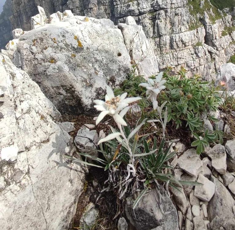
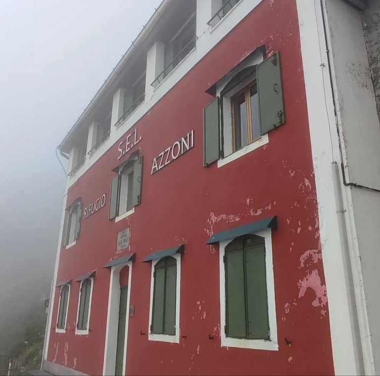
Dominante | Il rifugio degli Azzoni
Escursione sulle pendici del Resegone, passando per il rifugio Azzoni
Resegone (1.875 metri slm) è chiamato per la sua forma, il nome deriva infatti dal dialetto lecchese Resegun che significa Grande Sega.
Il suo profilo è molto conosciuto in Brianza e anche a Milano. Ci sono molti modi per accedere. Le principali alternative sono mostrate nella sezione varianti. Il percorso più semplice parte da Brumano e Morterone ed è consigliato soprattutto nel periodo invernale. In estate consiglio di prendere la funivia fino ai Piani d'Erna e proseguire a piedi seguendo il sentiero circolare.
Dominant | The Azzoni refuge
Hike on the slopes of Resegone, passing through the Azzoni refuge
Resegone (1,875 meters above sea level) is named for its shape; in fact, the name comes from the Lecco dialect Resegun, which means Great Saw.
Its profile is well known in Brianza and also in Milan. There are many ways to access it. The main alternatives are shown in the variants section. The easiest route starts from Brumano and Morterone and is recommended especially in winter time. In summer I recommend taking the cable car up to Piani d'Erna and continue on foot following the circular path.
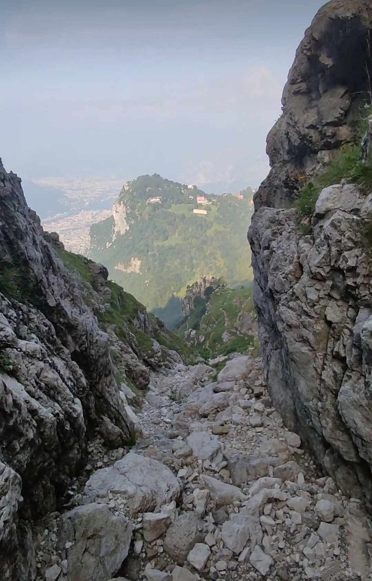
Il metodo 1, che spiegherò di seguito, è classificato come viaggio. Lo sconsiglio però alle famiglie per il tratto breve e qualche altro breve tratto, ma su una strada molto stretta con una valle a lato. Tuttavia, questa strada è in ottime condizioni e offrirà bellissimi turisti.
Con una buona ed ampia strada si raggiunge facilmente la stazione della funivia per i Piani d'Erna, dove troverete un ampio parcheggio. Monte Resegone: la via verso la cima del monte
Lasciare l'auto alla stazione degli autobus di Piani d'Erna.
Se siete escursionisti esperti potete proseguire a piedi prendendo il sentiero 1 che inizia a destra del piazzale dell'auto Per evitare questa parte della foresta, che è costosa, potete prendere una funivia. Risparmierai 400 metri di dislivello. Una volta arrivati ai Piani d'Erna, vedrete il bellissimo panorama del Resegone, che apparirà davanti a tutte le sue vette.
Method 1, which I will explain below, is classified as a trip. However, I do not recommend it for families because of the short section and some other short sections, but on a very narrow road with a valley on the side. However, this road is in very good condition and will offer beautiful tourists.
With a good, wide road you can easily reach the cable car station for Piani d'Erna, where you will find ample parking. Mount Resegone: the way to the top of the mountain.
Leave your car at the Piani d'Erna bus station.
If you are an experienced hiker, you can continue on foot by taking Trail 1, which starts to the right of the car yard To avoid this part of the forest, which is expensive, you can take a cable car. You will save 400 meters of elevation gain. Once you get to Piani d'Erna, you will see the beautiful panorama of Resegone, which will appear in front of all its peaks.
Istruzioni:
Seguire la strada forestale che scende e proseguire per 300 metri fino alla Bocchetta d'Erna a 1291 metri e imboccare il sentiero numero 7. La prima parte del sentiero attraversa il bosco su fondo sterrato. In basso si può ammirare il bellissimo panorama della città di Lecco, del Monte Barro, del Cornizzolo, dei Corni di Canzo e del Moregallo. Usciti dal campo proseguire fino a raggiungere la strada n. 1 della valle. Immaginate di iniziare a salire lungo il fianco della parete rocciosa e di seguire il tratto del Resegone attraverso ampi gradoni erbosi. Davanti a voi vedrete la Cima Quarenghi, la Corna Camozzera, il Monte Ocone e dietro il Monte Tesoro e il Monte Linzone con le sue antenne.
Instructions:
Follow the forest road downhill and continue for 300 meters to Bocchetta d'Erna at 1291 meters and take trail number 7. The first part of the trail goes through the forest on a dirt surface. Below you can admire the beautiful panorama of the city of Lecco, Monte Barro, Cornizzolo, Corni di Canzo and Moregallo. Leaving the field, continue until you reach valley road No. 1. Imagine starting to climb along the side of the cliff face and following the Resegone section across wide grassy steps. In front of you you will see Cima Quarenghi, Corna Camozzera, Monte Ocone, and behind you Monte Tesoro and Monte Linzone with its antennas.
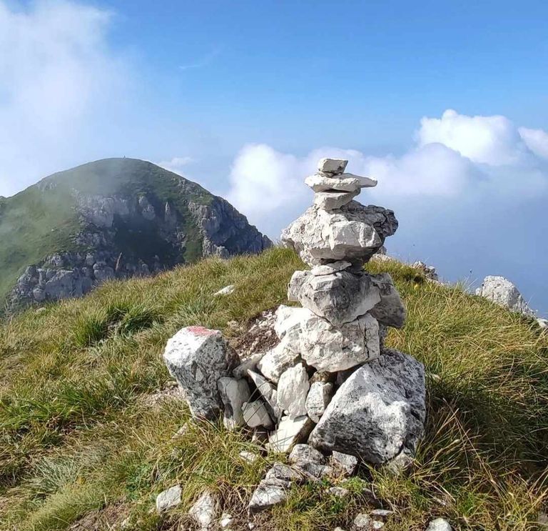
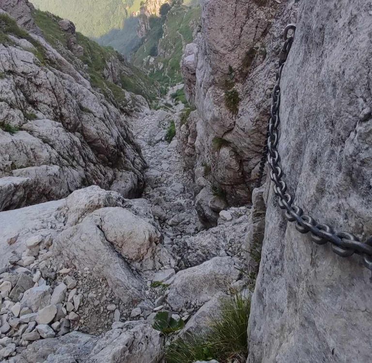
Dopo un lungo curvone il sentiero riprende a salire e superiamo il primo sasso. All'inizio il sentiero non presenta problemi, ma col passare del tempo si inizieranno a trovare tratti stretti nei valloni laterali a cui bisogna fare attenzione.
Ci sono anche circa 10 metri di funivia. Non vi è alcun punto di difficoltà, ma vale la pena assicurarsi che la pietra sia scivolosa.
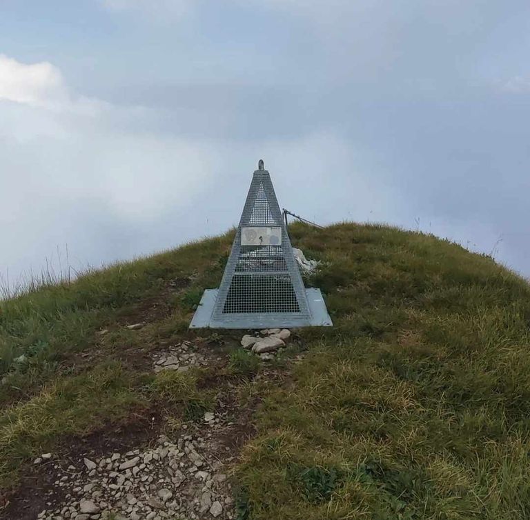
Il rifugio è sotto la croce del monte. Dalla cima del Resegone il panorama è bellissimo. A nord-ovest si vede in lontananza il monte Due Mani e alle sue spalle la Grignetta e il Grignone. Guardando a nord vediamo i monti del Legnone, del Legnoncino e della Valtellina.
A nord-est la valle Imagna ha alle spalle l'Alben, il Pizzo Arera, i monti del Linzone e numerose cime dei monti bergamaschi.
After a long bend the trail starts climbing again and we pass the first boulder. At first the trail does not present any problems, but as time passes you will begin to find narrow sections in the side valleys that you need to be careful of.
There are also about 10 meters of cable car. There is no point of difficulty, but it is worth making sure the stone is slippery.
The hut is below the cross of the mountain. From the top of Resegone the view is beautiful. To the northwest we can see Mount Due Mani in the distance and behind it the Grignetta and Grignone. Looking north we see the Legnone, Legnoncino and Valtellina mountains.
To the northeast the Imagna valley has the Alben, Pizzo Arera, the Linzone mountains and numerous peaks of the Bergamo mountains behind it.
Per il ritorno si può decidere di seguire l'itinerario dell'andata, che rimane interessante e difficile, oppure fare un lungo viaggio di andata e ritorno e seguire il sentiero facile senza pericoli di ogni vita.
Se scegliete questa soluzione seguite la mappa che ho pubblicato all'inizio dell'articolo e prendete il sentiero che porta a Brumano. Giunti al Colletto di Brumano si svolta a sinistra sulla strada che porta al Col de Giuff. Da lì si ritorna a Bocchetta d'Erna su sentiero buono e pianeggiante. Tipo 1: ritorno dal metodo 1.
Raggiunta la vetta del Resegone si può valutare il rientro dal percorso effettuato durante l'escursione. Con questa soluzione la lunghezza del percorso diventa 7,8 km con un dislivello di 930 metri e un tempo di percorrenza di 4 ore.
For the return trip you can decide to follow the outward route, which remains interesting and difficult, or take a long round trip and follow the easy path without danger of any life.
If you choose this solution, follow the map I posted at the beginning of the article and take the trail to Brumano. When you reach Colletto di Brumano, turn left onto the road that leads to Col de Giuff. From there you return to Bocchetta d'Erna on a good, level path. Type 1: Return from method 1.
Upon reaching the summit of Resegone, one can consider returning from the route taken during the hike. With this solution, the trail length becomes 7.8 km with an elevation gain of 930 meters and a walking time of 4 hours.
Tipologia 2: Uscita dal piazzale della funivia
Per i viaggiatori ben allenati è consigliabile seguire integralmente il percorso numero 1 che dall'uscita della stazione degli autobus vi condurrà fino alla vetta del Monte Resegone. Il
Tipologia 3: Partenza da Brumano
Il percorso con partenza da Brumano è il più sicuro e può essere percorso con la famiglia in tutta tranquillità. Affinché ciò avvenga, però, è necessaria una buona formazione
Tipo 2: Partenza dalla stazione della funivia
Per i viaggiatori ben allenati è consigliabile seguire integralmente il percorso 1, che dall'uscita della funivia vi porterà in cima al monte Resegone.
Tipologia 3: Partenza da Brumano
Type 2: Exit from the cable car apron
For well-trained travelers, it is advisable to follow route number 1 in its entirety, which will take you from the exit of the bus station to the summit of Mount Resegone. The
Type 3: Departure from Brumano
The route with departure from Brumano is the safest and can be walked with the family in peace. For this to happen, however, good training is required.
Type 2: Departure from the cable car station
For well-trained travelers, it is advisable to follow route 1 in its entirety, which will take you from the cable car exit to the top of Mount Resegone.
Type 3: Departure from Brumano
Il percorso con partenza da Brumano è il più sicuro e può essere percorso con la famiglia in tutta tranquillità. Tuttavia, un buon allenamento è importante perché prevede la percorrenza di 9 km e un dislivello di 900 metri.
Ricordiamo inoltre che arrivare a Brumano in macchina è molto diverso da arrivare in macchina ai Piani d'Erna. La strada è davvero tortuosa e stretta. Consiglio questa soluzione solo se si vuole raggiungere la cima della montagna con un percorso sicuro. Se invece l'obiettivo è la massima sicurezza si può considerare la salita al Resegone partendo dai Piani d'Erna e percorrendo i tratti di andata e ritorno che consiglio principalmente per la discesa dalla vetta. Se ti piace questa opzione, parti dai Piani d'Erna, raggiungi il Col de Giuff e prosegui fino al Colletto di Brumano. Da lì si risale la montagna tramite un sentiero che attraversa il colle erboso del Resegone.
The route starting from Brumano is the safest and can be walked with the family in peace. However, good training is important because it involves running 9 km and an elevation gain of 900 meters.
Remember also that getting to Brumano by car is very different from getting to Piani d'Erna by car. The road is really winding and narrow. I recommend this solution only if you want to reach the top of the mountain by a safe route. If, on the other hand, maximum safety is the goal, you can consider the ascent to Resegone starting from Piani d'Erna and walking the round-trip sections, which I recommend mainly for the descent from the summit. If you like this option, start from the Piani d'Erna, reach the Col de Giuff and continue to the Colletto di Brumano. From there you go up the mountain via a trail that crosses the grassy Resegone hill.
Sala TV
Clicca sulle immagini per ingrandire e sull'icona in basso a sinistra per vederle a schermo intero in 4K Si trova tra le regioni di Lecco e Bergamo e, in particolare, sul versante occidentale si trova la città di Lecco.
Alla fama del Monte Resegone contribuì molto Alessandro Manzoni, che lo descrisse all'inizio dei Promessi Sposi:
La Costa, formata dai depositi di tre grandi corsi d'acqua, discende e si appoggia su due monti che si uniscono, l'uno chiamato San Martino, l'altro, nel collo longobardo, Resegone, e si combinano le sue diverse letture, che infatti la fanno sembrare come una pianta: Quindi nessuno, la vede dapprima, purché sia di fronte, ad esempio sul muro di Milano guardando verso nord, non si capisce subito, da un tale segno, che questo lungo e largo fanon , a lui altre montagne dai nomi insoliti e dalle forme comuni Canalone Bobbio (percorso 10).
TV Room
Click on the images to enlarge and on the icon at the bottom left to see them in full screen in 4K It is located between the regions of Lecco and Bergamo and, in particular, on the western slope is the city of Lecco.
Alessandro Manzoni contributed greatly to the fame of Mount Resegone, who described it at the beginning of The Betrothed:
The Coast, formed by the deposits of three great streams, descends and rests on two mountains that join together, the one called San Martino, the other, in the Lombard neck, Resegone, and combine its different readings, which in fact make it look like a plant: So no one, sees it at first, provided he is facing it, for example on the wall of Milan looking northward, does not immediately understand, from such a sign, that this long and wide fanon , to him other mountains of unusual names and common forms Canalone Bobbio (route 10).
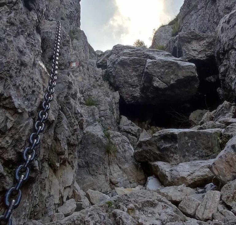
Con corde e catene, questo percorso che parte dai Piani d'Erna e risale l'impossibile Canalone Bobbio è riservato agli escursionisti professionisti. Un casco da ferrata può aiutare, perché c'è il
rischio che persone o animali muovano massi. Si sconsiglia di percorrerlo a terra e nelle ore migliori della giornata, perché il sentiero è esposto ma poco ombreggiato; Quindi il momento migliore è la mattina. In ogni caso il sentiero, seppure molto utilizzato, è spesso ben segnalato. Stagione: da maggio a ottobre è difficile pedalare in montagna se c'è la neve. Saperne di più
Il Resegone di Morterone (linee 16-17)
Il Morterone è la via più semplice per scalare il monte Resegone. Il metodo, infatti, è molto basilare e non richiede competenze tecniche. In inverno, se c'è neve, è possibile percorrere lo stesso sentiero con ramponi, ciaspole o sci alpinismo, a seconda delle condizioni della neve. Il dislivello in generale è di oltre 800 metri e la salita dura circa 1 ora e 30 minuti, che con la neve possono essere due ore e mezza. Saperne di più
With ropes and chains, this route from Piani d'Erna up the impossible Canalone Bobbio is for professional hikers only. A via ferrata helmet can help, because there is the
risk of people or animals moving boulders. It is not recommended to hike it on the ground and during the best hours of the day, because the trail is exposed but little shade; So the best time is in the morning. In any case, the trail, while heavily used, is often well marked. Season: From May to October it is difficult to ride in the mountains if there is snow. Learn more about.
Resegone di Morterone (lines 16-17)
The Morterone is the easiest way to climb Mount Resegone. In fact, the method is very basic and requires no technical skills. In winter, if there is snow, it is possible to walk the same path with crampons, snowshoes or ski mountaineering, depending on snow conditions. The overall elevation gain is over 800 meters and the ascent takes about 1 hour and 30 minutes, which with snow can be two and a half hours. Learn more

Itinerario alla Capanna Alpinisti Monzesi da Lecco (percorsi 1-6)
Il sentiero escursionistico porta da Lecco al rifugio Capanna Monzesi, nei pressi del Passo del Fo'. Sebbene sia ampiamente utilizzato in alcuni luoghi, non rappresenta alcun pericolo. Il dislivello è di tutto rispetto: circa 700 metri, per una durata di 2 ore. Il tragitto si svolge quasi interamente nel bosco, tanto che è possibile anche nel mese migliore dell'anno. Scopri di più
Altre gite del gruppo Resegone:
Piani d'Erna dal Col de Cammello
Vestiti di cocco
Magnodeno di Lecco
Monte Due Mani de Morterone
Il Monte Due Mani visto dalla vetta del Resegone
Guardie di sicurezza
Rifugio Luigi Azzoni – Monte Resegone (quota 1.875 m)
Passo Monzesi – Col de Fo' (altitudine 1.170 m)
Marchett - Piani d'Erna (altitudine 1.248 m)
Rifugio Antonio Stoppani - ubicazione. Mare (890 m di altitudine)
Rifugio – Brumano, BG (quota 1.264 m)
Itinerary to the Capanna Alpinisti Monzesi hut from Lecco (routes 1-6)
This hiking trail leads from Lecco to the Capanna Monzesi hut near Passo del Fo'. Although it is widely used in some places, it poses no danger. The elevation gain is respectable: about 700 meters, for a duration of 2 hours. The route takes place almost entirely in the forest, so much so that it is possible even in the best month of the year. Learn more
Other trips in the Resegone group:
Piani d'Erna from Col de Cammello
Coconut Clothes
Magnodeno of Lecco
Mount Due Mani de Morterone
Mount Due Mani as seen from the summit of Resegone
Security Guards
Luigi Azzoni Refuge - Mount Resegone (elevation 1,875 m)
Monzesi Pass - Col de Fo' (elevation 1,170 m)
Marchett - Piani d'Erna (altitude 1,248 m)
Antonio Stoppani Refuge - location. Mare (altitude 890 m)
Refuge - Brumano, BG (elevation 1,264 m)